Fereej Al Manaseer
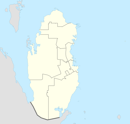
Fereej Al Manaseer (Arabic: فريج المناصير) is a district in Qatar, located in the municipality of Al Rayyan.[3][4]
Fereej Al Manaseer فريج المناصير | |
|---|---|
District | |
 Fereej Al Manaseer | |
| Coordinates: 25.248926°N 51.428451°E | |
| Country | |
| Municipality | Al Rayyan |
| Zone | Zone 55 |
| District no. | 87 |
| Area | |
| • Total | 0.3 km2 (0.1 sq mi) |
| Elevation | 22 m (72 ft) |
In the 2015 census, it was listed as a district of Zone 55 which has a population of 283,675 and also includes Bu Sidra, Al Aziziya, Al Waab, Fereej Al Soudan, Muaither, Al Mearad, New Fereej Al Ghanim, Fereej Al Murra and Al Sailiya.[3]
Geography
It borders Bu Sidra to the south, Al Aziziya to the east, Baaya to the north and Muaither to the north and west.[4]
Transport
Currently, the underground Al Manaseer Metro Station is under construction. Once completed, it will be part of Doha Metro's Gold Line. Construction was launched during Phase 2A.[5]
Gallery
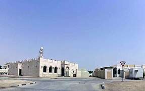
 Mosque on Bu Erayyen Street in Fereej Al Manaseer.
gollark: You probably can.
gollark: Why?
gollark: Encode the binary data in unary, simple.
gollark: Yes, not no.
gollark: Also, I just realised: any language can be converted to a ***one***-char version, trivially.
References
- "District Area Map". Ministry of Development Planning and Statistics. Retrieved 12 February 2019.
- "Fereej Al Manaseer, Zone 55, Qatar on the Elevation Map". elevationmap.net. Retrieved 2 January 2019.
- "2015 population census" (PDF). Ministry of Development Planning and Statistics. Retrieved 1 January 2019.
- "District map". The Centre for Geographic Information Systems of Qatar. Retrieved 1 January 2019.
- "QAR Metro". arcgis.com. Retrieved 17 March 2019.
This article is issued from Wikipedia. The text is licensed under Creative Commons - Attribution - Sharealike. Additional terms may apply for the media files.