Father Capodanno Boulevard
Father Capodanno Boulevard, formerly called Seaside Boulevard, is primary north-south artery that runs through the Arrochar, South Beach, Ocean Breeze, Midland Beach, and New Dorp Beach neighborhoods of New York City, in the borough of Staten Island, New York. The boulevard runs parallel to the South Beach Boardwalk and public park.
| Length | 2.60 mi (4.18 km) |
|---|---|
| Location | Richmond |
| North end | Lily Pond Avenue |
| South end | Miller Field |
History
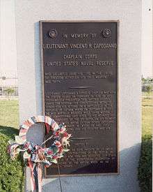
Fr. Capodanno Boulevard was originally conceived by New York City parks commissioner Robert Moses as the northernmost stretches of a planned limited-access highway to be named Shore Front Drive. The road was built in 1955-1958 as Seaside Boulevard as part of an improvement to the boardwalk.[1] The first section of the avenue opened in 1957.[2] Opening as Seaside Boulevard, the boulevard's name was changed in 1976 to honor Vincent R. Capodanno, a local Roman Catholic chaplain who was killed in the Vietnam War in 1967.[3][4]
Description
The road exists today as the primary boulevard for the communities and public parks of Staten Island's East Shore. The road currently consists of six vehicular lanes: four driving lanes, a parking lane with turning bays southbound and a bus lane northbound. Previously existing bicycle lanes were removed in 2010 "without any discernible public process".[5] Northbound and southbound traffic is divided by a grassy center median. As island traffic and congestion has increased in recent years, Father Capodanno Boulevard has also started to be used as a "short cut" to the Verrazano-Narrows Bridge by residents of the islands more inland and Southern communities.
The S51/S81 and S52 local buses use this street, as do the SIM5, SIM6, SIM9 express routes.[6][7]
The entire boulevard suffered extensive damage and flooding during Hurricane Sandy in October 2012.
Major intersections
Major intersections include:
- Lily Pond Avenue (western end)
- Sand Lane
- Seaview Avenue
- Jefferson Avenue
- Hunter Avenue
- Midland Avenue
- Lincoln Avenue
- Greeley Avenue
References
- "Ground is broken for boardwalk on Staten Island". Brooklyn Times-Union. August 11, 1935. p. 24. Retrieved September 18, 2019 – via newspapers.com

- "New Road to Open on Staten Island; New Boulevard Leads Way to Richmond Shore Project". The New York Times. October 28, 1957. Retrieved September 20, 2019.
- Engels, Mary (June 20, 1976). "On the Isle". New York Daily News. p. 938. Retrieved September 21, 2019 – via newspapers.com
- "Franklin D. Roosevelt Boardwalk and Beach Highlights". Capodanno Memorial : NYC Parks. June 26, 1939. Retrieved September 21, 2019.
- Bicycle Lane Removed from Father Capodanno Blvd on Staten Island
- "Staten Island Bus Map" (PDF). Metropolitan Transportation Authority. August 2018. Retrieved August 18, 2018.
- "MTA express bus changes: New SIM9, South Shore extension and more". SILive.com. Retrieved 2018-09-19.