Fasil Ghebbi
The Royal Enclosure (Amharic: ፋሲል ግቢ, or Fasil Ghebbi) is the remains of a fortress-city in Gondar, Ethiopia. It was founded in the 17th century by Emperor Fasilides (Fasil) and was the home of Ethiopia's emperors. Its unique architecture shows diverse influences including Nubian styles. The site was inscribed as a UNESCO World Heritage Site in 1979. Ghebbi is an Amharic word for a compound or enclosure.[1]
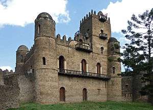
 Emperor Fasilides' castle, founded by him in the 17th century | |
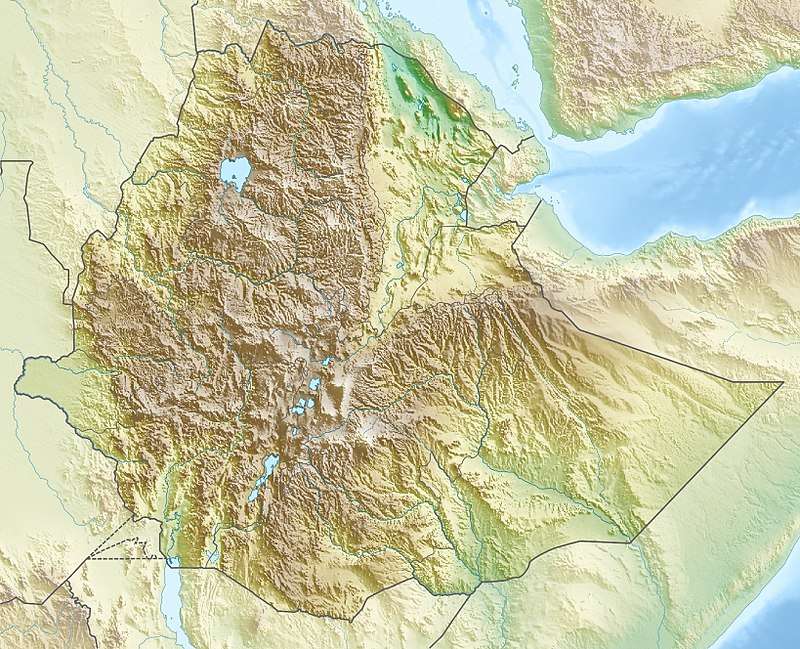
 Shown within Ethiopia | |
| Location | Gondar, North Gondar Zone, Amhara Region, Ethiopia |
|---|---|
| Coordinates | 12°36′27″N 37°28′12″E |
| History | |
| Founded | 17th century |
| Official name | Fasil Ghebbi, Gondar Region |
| Type | Cultural |
| Criteria | (ii), (iii) |
| Designated | 1979 (3rd session) |
| Reference no. | 19 |
| Region | Africa |
The complex of buildings includes Fasilides' castle, Iyasu I's palace, Dawit III's Hall, a banqueting hall, stables, Empress Mentewab's castle, a chancellery, library and three churches: Asasame Qeddus Mikael, Elfign Giyorgis and Gemjabet Mariyam.
History
The origins of the Fasil Ghebbi can be found in the old tradition of the Ethiopian emperors to travel around their possessions, living off the produce of the peasants and dwelling in tents. Reflecting this connection, this precinct was frequently referred to as a katama ("camp" or "fortified settlement") or makkababya, the name applied to the imperial camp in the Royal Chronicle of Baeda Maryam.[2]
Emperor Fasilides broke with this tradition of progressing through the territories, and founded the city of Gondar as his capital; its relative permanence makes the city historically important. Within the capital, he commanded the construction of an imposing edifice, the Fasil Gemb or Fasilides castle. The area around the Fasil Gemb was delineated by a wall with numerous gates. Subsequent emperors built their own structures, many of which survive either in whole or part today.[3] Visiting the Fasil Ghebbi in the late 1950s, Thomas Pakenham observed that "dotted among the palaces are what remains of the pavilions and kiosks of the imperial city".[4] The original buildings were influenced by Arab and Hindu architectural design, with later Baroque Architectural styling introduced by Jesuit Missionaries[5]
Description
Fasil Ghebbi covers an area of about 70,000 square meters. To its south lies Adababay, the market place of Gondar, where imperial proclamations were made, troops presented, and criminals executed; it is currently a city park.[6]
Dawit's Hall is in the northern part of the enclosure, adjacent to the building attributed to Bakaffa and the church of Asasame Qeddus Mikael. Often referred to as the "House of Song", Munro-Hay notes that this may be due to a misreading of the Amharic zofan bet ("House of the Divan" or "House of the Throne") as zafan bet ("House of Song"). Munro-Hay describes it as a "substantial one-storey building with a round tower at the southeast corner", with traces of a smaller round tower at the northeast corner and traces of a square tower at the northwest corner "most of which has collapsed." The interior of the building is a single long hall, which "the usual arched windows and doorways provided light and access". As of 2002, Dawit's Hall lacks a roof.[7]
Fasil Ghebbi is enclosed by a curtain wall which is pierced by twelve gates. These are, in counter-clockwise order: Fit Ber (also called Jan Tekle Ber) opening onto Adababay; Wember Ber (Gate of the Judges); Tazkaro Ber (Gate of Funeral Commemoration), which had a bridge destroyed by fighting during the reign of Iyasu II; Azaj Tequre Ber (Gate of Azaj Tequre), which once was connected by a bridge to Adababay Tekle Haymanot church; Adenager Ber (Gate of the Spinners), which was linked by a bridge to Qeddus Rafael church in the weaver's section of Gondar; Qwali Ber (Gate of the Queen's Attendants), next to the modern entrance to Elfin Giyorgis church inside the Enclosure; Imbilta Ber (Gate of the Musicians); Elfign Ber (Gate of the Privy Chamber), which gave access to the private apartments of the Fasil Ghebbi; Balderas Ber (Gate of the Commander of the Cavalry); Ras Ber (Gate of the Ras), also known as Qwarenyoch Ber (Gate of the Qwara people); Ergeb Ber (Gate of Pigeons), also known as Kechin Ashawa Ber (Gate of the Gifts); Inqoye Ber (Gate of Princess Inqoye, the mother of Empress Mentewab; and Gimjabet Mariyam Ber (Gate of the Treasury of Mary), which leads to the churchyard of Gimjabet Mariyam church.[8]
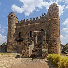
 Side entrance to Fasil Gemb
 Interior of Fasilides' Palace
 Palace of Iyasu I
 Palace of Iyasu I
 Royal library building
 Royal archive building
3D documentation with terrestrial laser scanning
The Zamani Project documented Fasil Ghebbi in the center of Gondar with terrestrial 3D laser scanning [9][10][11]. The structures documented include: the Castle of Emperor Fasilides, the Bakaffa Castle, Dawit III’s Hall, the Castle of Emperor Iyasu, the Royal Library, the Chancellery, the Royal Archive Building .
Some of the textured 3D models, a panorama tour, elevations, sections and plans are available on www.zamaniproject.org.
References
- Appleyard, David (2013). Colloquial Amharic (2nd ed.). Routledge.
- Munro-Hay, Ethiopia, the unknown land: a cultural and historical guide (London: I.B. Tauris, 2002), p. 118
- Richard Pankhurst, The Ethiopians: A History (Oxford: Blackwell, 2001), pp. 109f
- Pakenham, The Mountains of Rasselas (New York: Reynal & Co., 1959), p. 42
- "Fasil Ghebbi, Gondar Region". UNESCO World Heritage. Retrieved 13 December 2019.
- Munro-Hay, Ethiopia, pp. 114f
- Munro-Hay, Ethiopia, pp. 126-128
- Munro-Hay, Ethiopia, pp. 118-120
- "Site - Fassil Ghebbi - Gondar". zamaniproject.org. Retrieved 2019-10-07.
- Rüther, Heinz; Rajan, Rahim S. (2007). "Documenting African Sites: The Aluka Project". Journal of the Society of Architectural Historians. 66 (4): 437–443. doi:10.1525/jsah.2007.66.4.437. ISSN 0037-9808. JSTOR 10.1525/jsah.2007.66.4.437.
- Rüther, Heinz (2002). "An African Heritage Database: The Virtual Preservation of Africa's Past" (PDF). International Society for Photogrammetry and Remote Sensing. Retrieved 2 October 2019.