Farthingstown
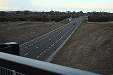
Farthingstown is a townland in County Westmeath, Ireland.[1][2] The townland is located on the border with County Offaly and is in the civil parish of Castlelost. The M6 Motorway runs through the middle, with a junction linking up with the R400 regional road. The Monagh River flows through the south of the area. The town of Rochfortbridge is to the north.[3][4]
History

On the Griffith Valuation of 1868, Farthingstown is recorded as having over 40 tenants in the area. Most of the properties at that time are owned by the local Rochfort family, based at nearby Belvedere House and Gaulstown.
Sidebrook House
Sidebrook house is a large two-story home dating back to c1815. The house features a unique L-shaped layout. It stands close to the junction with the R400 regional road and the M6 motorway.[5]
See also
References
- "Farthingstown Townland, Co. Westmeath". www.townlands.ie. Retrieved 2020-04-21.
- "Farthingstown". Logainm.ie. Retrieved 2020-08-13.
- General Alphabetical Index to the Townlands and Towns, Parishes, and Baronies of Ireland: Based on the Census of Ireland for the Year 1851. Genealogical Publishing Com. 1984. ISBN 978-0-8063-1052-7.
- "The Tithe Applotment Books, 1823-37". titheapplotmentbooks.nationalarchives.ie. Retrieved 2020-04-21.
- FUSIO. "Sidebrook House, FARTHINGSTOWN, Rochfortbridge, County Westmeath". Buildings of Ireland. Retrieved 2020-08-13.