Farrar, Georgia
Farrar is an unincorporated community in Jasper County, Georgia, United States.[1] The community is located along Highway 142 approximately fifty miles southeast of Atlanta, Georgia.
Farrar, Georgia | |
|---|---|
 Farrar, Georgia | |
| Coordinates: 33°27′46″N 83°38′03″W | |
| Country | United States |
| State | Georgia |
| County | Jasper |
| Elevation | 692 ft (211 m) |
| Time zone | UTC-5 (Easter (EST)) |
| • Summer (DST) | UTC-4 (EDT) |
Demographics
| Historical population | |||
|---|---|---|---|
| Census | Pop. | %± | |
| 1930 | 15 | — | |
| 1940 | 16 | 6.7% | |
| 1950 | 30 | 87.5% | |
| 1960 | 42 | 40.0% | |
| 1970 | 87 | 107.1% | |
| Sources: U.S. Census Bureau[2][3][4] | |||
Farrar, Georgia was first recorded in the 1930 census. As Farrar is no longer an incorporated town, census data is no longer collected on the community as a whole.
gollark: Set up a regular 5G cell tower, but then add a really directed antenna and broadcast unreasonable amounts of power from it.
gollark: At an admittedly optimistic data rate of 1Gbps, I could use up my entire data cap in 64 seconds.
gollark: I just don't think that stupidly high bandwidth and low latency is particularly necessary on mobile internet connections and worth the extra cost, especially with data caps.
gollark: eBay.
gollark: More seriously, 5G isn't *just* the mmWave thing with terrible range, IIRC it can use existing spectrum a bit better.
References
- "Farrar". Geographic Names Information System. United States Geological Survey.
- Georgia: 1940 - Population, 1940 Census https://www2.census.gov/library/publications/decennial/1940/population-volume-1/33973538v1ch04.pdf
- Georgia: 1960 - Population, 1960 Census https://www2.census.gov/library/publications/decennial/1960/population-volume-1/vol-01-12-c.pdf
- Georgia: 1970 - Population, 1970 Census http://earlyushistory.net/wp-content/uploads/2014/05/1970-population-characteristics-part-1-georgia-extracted.pdf
Municipalities and communities of Jasper County, Georgia, United States | ||
|---|---|---|
| City | 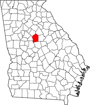 Map of Georgia highlighting Jasper County | |
| Town | ||
| Unincorporated communities | ||
This article is issued from Wikipedia. The text is licensed under Creative Commons - Attribution - Sharealike. Additional terms may apply for the media files.