Farmville, Chatham County, North Carolina
Farmville is a community in southeastern Chatham County, North Carolina which was once called Coal Glen. The area was the site of coal mining activities from the 18th century up the mid-1950s, and was the site of the 1925 Coal Glen mine disaster.
Farmville, North Carolina | |
|---|---|
Populated place | |
| Coordinates: 35°34′15″N 79°13′12″W | |
| Country | United States |
| State | North Carolina |
| County | Chatham |
| Elevation | 282 ft (86 m) |
| Time zone | UTC-5 (Eastern (EST)) |
| • Summer (DST) | UTC-4 (EDT) |
| ZIP code | 27330 |
| Area code(s) | 919 |
| GNIS feature ID | 1020221 |
The Deep River coal field, 12 miles (19 km) long, included the Coal Glen and Egypt (Cumnock) mines.[1]
A historical marker noting the mine disaster was dedicated June 3, 2017 at Farmville Community Church at U.S. 15-501 and Walter Bright Road north of Sanford.[2]
Geography
Farmville is located at latitude 35|34|15|N| and longitude 79|13|12|W. The elevation is 282 feet (86 m).[3]
gollark: My wrath may just consist of me asking every 5 minutes.
gollark: 6_4: give me the code or face my wrath.
gollark: 6_4: code plox.
gollark: Ah yes, MattHołełł.
gollark: What do you mean the URL?
References
- Leonard, Teresa (2017-06-02). "Highway marker stirs memories of 1925 coal mine disaster". News & Observer. Retrieved 2017-06-02.
- "Coal Glen Mine Disaster NC Highway Historical Marker Dedication" (PDF). Retrieved 2017-06-02.
- "Farmville (in Chatham County, NC) Populated Place Profile". NC Hometown Locator. Retrieved 2017-06-02.
- UNC Library: This Month in North Carolina History: The Coal Glen Mine Disaster
- William S. Powell, The North Carolina Gazetteer (Chapel Hill: UNC Press, 1968).
External links
Municipalities and communities of Chatham County, North Carolina, United States | ||
|---|---|---|
| Towns | 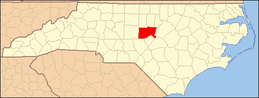 | |
| CDPs | ||
| Unincorporated communities | ||
| Footnotes | ‡This populated place also has portions in an adjacent county or counties | |
This article is issued from Wikipedia. The text is licensed under Creative Commons - Attribution - Sharealike. Additional terms may apply for the media files.