Farm to Market Road 2696
Farm to Market Road 2696 (FM 2696) is a 16.028-mile (25.795 km) farm to market road in Bexar County, Texas.[1] It is known in Greater San Antonio as Blanco Road, a major north–south thoroughfare.[1]
| ||||
|---|---|---|---|---|
| Blanco Road | ||||
| ||||
| Route information | ||||
| Length | 16.028 mi[1] (25.795 km) | |||
| Existed | 1961–present | |||
| Major junctions | ||||
| South end | ||||
| North end | at San Antonio City Limits | |||
| Location | ||||
| Counties | Bexar | |||
| Highway system | ||||
| ||||

Route description
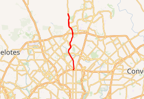
FM 2696 begins at Interstate 410 at the western fringe of Uptown San Antonio, just east of Castle Hills.[2] The route travels north through north central San Antonio, crossing Wurzbach Parkway and Loop 1604. It then runs along the eastern edge of the Camp Bullis Military Training Reservation. The designation ends just south of the Comal County line; however, Blanco Road itself continues into Comal County to an intersection with SH 46.[1][3]
History
FM 2696 was designated on March 22, 1961, from Loop 410 (now Interstate 410) northward 8.6 miles (13.8 km) to the Camp Bullis Entrance. FM 2696 was extended north three times: by 3.2 miles (5.1 km) on September 29, 1977, 1.9 miles (3.1 km) on October 21, 1981, and 2.1 miles (3.4 km) to near the Comal County line on October 26, 1983.[1] The segment between IH 410 and Loop 1604 was officially changed to Urban Road 2696 (UR 2696) on June 27, 1995; the designation reverted to FM 2696 with the elimination of the Urban Road system on November 15, 2018.[4]
On December 18, 2014, the northernmost 6.2 miles (10.0 km) of the route, from the San Antonio city limit near Calico Landing to the Comal County line, was removed from the state highway system and returned to Bexar County.[5] A previous turnback proposal would have decommissioned the entirety of FM 2696, but it was rejected by San Antonio city officials. The city instead passed a different proposal, which also resulted in the turnback of many other highways, on the day that FM 2696 was truncated.[6][7]
Major intersections
The entire route is in Bexar County.
| Location | mi[8] | km | Destinations | Notes | |
|---|---|---|---|---|---|
| San Antonio | 0.0 | 0.0 | Southern terminus | ||
| 2.8 | 4.5 | Wurzbach Parkway | |||
| 6.6 | 10.6 | ||||
| | 16.1 | 25.9 | Comal County line | Northern terminus | |
| 1.000 mi = 1.609 km; 1.000 km = 0.621 mi | |||||
References
- Transportation Planning and Programming Division (n.d.). "Farm to Market Road No. 2696". Highway Designation Files. Texas Department of Transportation. Retrieved December 1, 2014.
- Transportation Planning and Programming Division (2014). Texas County Mapbook (PDF) (Map) (2014 ed.). 1:120,000. Texas Department of Transportation. p. 339. Retrieved December 1, 2014.
- Transportation Planning and Programming Division (2014). Texas County Mapbook (PDF) (Map) (2014 ed.). 1:120,000. Texas Department of Transportation. p. 338. Retrieved December 1, 2014.
- "Minute Order 115371" (PDF). Texas Transportation Commission. November 15, 2018. Retrieved July 30, 2020.
- "Minute Order 114164" (PDF). Texas Transportation Commission. December 18, 2014. Retrieved January 4, 2015.
- Davila, Vianna (November 20, 2013). "City officials say no to TxDOT turnback program". San Antonio Express-News. Retrieved August 10, 2020.
- https://sanantonio.legistar.com/LegislationDetail.aspx?ID=1520507&GUID=2B8D75CC-ED18-4C40-8C17-6B871569CC03. Missing or empty
|title=(help) - Google (January 5, 2011). "Overview map of Farm to Market Road 2696 Distances Between Interchanges" (Map). Google Maps. Google. Retrieved January 5, 2011.