Fanning, Kansas
Fanning is an unincorporated community in Doniphan County, Kansas, United States. Fanning is located along K-7 5 miles (8.0 km) northwest of Troy.
Fanning, Kansas | |
|---|---|
Unincorporated community | |
 Fanning, Kansas  Fanning, Kansas | |
| Coordinates: 39°50′05″N 95°09′41″W | |
| Country | United States |
| State | Kansas |
| County | Doniphan |
| Elevation | 886 ft (270 m) |
| Time zone | UTC-6 (Central (CST)) |
| • Summer (DST) | UTC-5 (CDT) |
| Area code(s) | 785 |
| GNIS feature ID | 473026[1] |
History
Fanning had its start in the year 1870 by the building of the Burlington and Missouri River Railroad through that territory.[2]
A post office was opened in Fanning in December, 1870, and remained in operation until it was discontinued in July, 1933.[3]
gollark: I mostly think our current governance models are kind of awful but really hard to replace with anything which works better.
gollark: The Bible is something like a million words if I remember right, and I would have to filter out the irrelevant historical things and arbitrary rules if I wanted to read it as philosophy or something. Strictly speaking, I have time but not the attention span or any actual desire.
gollark: Yes.
gollark: Which doesn't make them sensible *now*, when people can cook things and nobody cares about mixed fabrics.
gollark: Very approximately?
References
- "Fanning". Geographic Names Information System. United States Geological Survey.
- Blackmar, Frank Wilson (1912). Kansas: A Cyclopedia of State History, Embracing Events, Institutions, Industries, Counties, Cities, Towns, Prominent Persons, Etc. Standard Publishing Company. pp. 621.
- "Kansas Post Offices, 1828-1961 (archived)". Kansas Historical Society. Archived from the original on October 9, 2013. Retrieved 8 June 2014.
Municipalities and communities of Doniphan County, Kansas, United States | ||
|---|---|---|
| Cities | 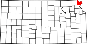 Map of Kansas highlighting Doniphan County | |
| CDP | ||
| Unincorporated communities | ||
| Ghost town | ||
| Indian reservation | ||
| Townships | ||
| Footnotes | ‡This populated place also has portions in an adjacent county or counties | |
This article is issued from Wikipedia. The text is licensed under Creative Commons - Attribution - Sharealike. Additional terms may apply for the media files.