Falkland, British Columbia
Falkland is a small community located in the North Okanagan—Shuswap region of British Columbia, Canada between Vernon and Kamloops.
Falkland | |
|---|---|
Community | |
 Downtown Falkland, near the intersection of Highway 97 and the Chase-Falkland Road. | |
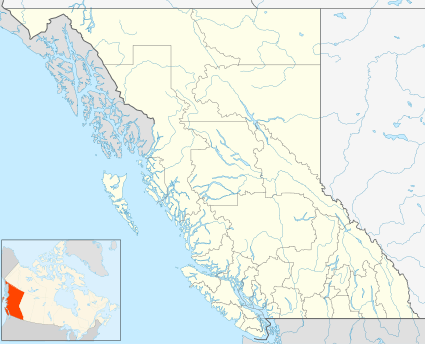
 Falkland Location in British Columbia  Falkland Falkland (Canada) | |
| Coordinates: 50°30′05″N 119°33′30″W | |
| Country | Canada |
| Province | British Columbia |
| Regional district | Columbia-Shuswap |
| Time zone | UTC−08:00 (PST) |
| Postal code | V0E 1W0 |
| Area code(s) | 250 / 778 / 236 |
| Highways | |
Falkland is recognized for one of Canada's largest Canadian flags, which is located on Gyp Mountain and can be seen up to 7 km (4.3 mi) away.[1] The Falkland area has a wide array of lakes for fishing and recreation. Also on the Victoria Day holiday, the Falkland Stampede begins. The Falkland Stampede is one of Canada's oldest stampedes.
Town history
The members of the Salish tribes frequently stayed in the Slahaltkan during the summer to gather the tribe's food for the winter. It was the job of the women to prepare the fish and meat for drying beside the fire. Where to put the meat caused slight disagreement among the women because the ever-changing breeze would cause the wind to blow in changing directions. Thus the valley was named "Slahaltkan", meaning "Meeting of the winds".
The name Slahaltkan was never used among the people who eventually settled in the area, although the sub-post office bore the name. When the settlement developed and they needed a postal address, the government asked if Colonel Falkland G.E. Warren, R.H.A.; C.M.G.; C.B. (an early European pioneer in the valley) would object to his name being used. The postal records from 1894 said that the proposals for the new post office in the area would either be "Falkland" or "Salmon River."
Rodeo
On March 24, 1919, in the gyp field in the northwest corner of the townsite, they gathered, never imagining that many decades later people from all over the world would come to Falkland to enjoy one of BC's most legendary events- the Falkland Stampede. The early years of the rodeo were filled with great ideas and the need for many things, including a fence to protect the spectators and a small corral to hold the horses. The first site chosen for the more permanent facilities was what then was the old mill site but now is known as the school ball field. Events included chuckwagon racing, bull riding, bucking horse riding and many other small games for the children and women.
Modern
Falkland hasn't really changed very much in the last few years. Many of the people who live in Falkland enjoy the lifestyle that the small community provides. The standard joke in Falkland was that if you blinked while driving through it you might miss it. While that may not be true, Falkland is still pretty small. In celebration of the war's end, the residents of Falkland and surrounding area planned a large picnic. Everyone was excited about the idea, especially the children who looked forward to the races, food and homemade ice cream.
Falkland's Canadian flag

- Location: 152.4 m (500 ft) above the valley floor on Gyp Mountain
- Height: 8.5 m (28 ft)
- Width: 17.1 m (56 ft)
- Flag's Structure: 2 X 6 lumber framework, eight 14 m (46 ft) telephone poles, 83.7 t (185,000 lb) cement blocks, and metal. 3,500 screws attach the metal together. The colours are heated onto enamel.
The Falkland flag is considered to be the biggest Canadian Flag in Western Canada. The purpose of building this flag was to support the I Care Campaign which received international attention when the people of Falkland challenged the rest of Canada to fly the Canadian Flag.[2]
The Canadian flag is illuminated at night, allowing visitors of Falkland to view the flag day and night. The power reaches the flag from a 7,000 m (23,000 ft) extension cord.[2] There were 19 corporate sponsors who donated material, equipment and labour. The total cost of the flag was $42,493 ($33,960 for construction, $3,343 lighting, and $5,190 lettering).
Mountains
Falkland is nestled at the confluence of three valleys and two rivers, the Salmon River and Bolean Creek, and is cradled by Tuktakamin Mountain (5811 feet/1771 metres) to the south, and Estekawalan Mountain to the west (5,960 ft [1,820 m]). These mountains create a type of valley.[1]
References
- "Falkland, British Columbia, Canada". BritishColumbia.com. Retrieved 2008-02-20.
- "Big Things". BritishColumbia.com. Retrieved 2009-04-19.
External links
- Falkland, British Columbia at BritishColumbia.com
- "Falkland (Community)". BC Geographical Names.
- BritishColumbia.com Falkland