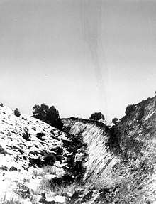
Fairview Peak (Churchill County, Nevada)
Fairview Peak is a summit in the Clan Alpine Mountains of the U.S. state of Nevada.[1] The elevation is 8,271 feet (2,521 m).[1]
Fairview Peak was so named on account of the scenic views it affords.[2] Variant names were "Fairview Cairn" and "Fairview Mountain".[1] The ghost town of Fairview, Nevada takes its name from the nearby peak.[2]
1954 earthquakes
A very large earthquake doublet occurred on December 16, 1954. The Dixie Valley/Fairview earthquakes occurred four minutes apart, each with a maximum Mercalli intensity of X (Extreme). The initial shock measured 7.3 Mw and the second shock measured 6.9 Mw . Damage to man-made structures was minimal because the region was sparsely populated at the time, but oblique-slip motion on a normal fault resulted in the appearance of large fault scarps.[3][4]

References
- U.S. Geological Survey Geographic Names Information System: Fairview Peak
- Federal Writers' Project (1941). Origin of Place Names: Nevada (PDF). W.P.A. p. 11.
- Stover, C.W.; Coffman, J.L. (1993), Seismicity of the United States, 1568–1989 (Revised), U.S. Geological Survey Professional Paper 1527, United States Government Printing Office, pp. 287, 288, 295, 296
- von Hake, Carl A. (November–December 1974). "Earthquake History of Nevada". Earthquake Information Bulletin. USGS. 4: 4. Retrieved April 29, 2020.