Eswatini–South Africa border
The border between Eswatini and South Africa is 430 kilometres (267 mi) long;[1][2][3] South Africa surrounds Eswatini to the north, west, south and southeast, with Mozambique bordering it on the northeast.

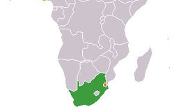
South Africa (green) and Eswatini (orange)

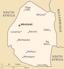
Eswatini is almost entirely surrounded by South Africa

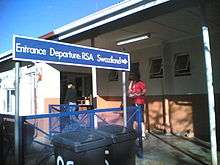
Border post
Crossings
The border crossings are listed from north to south in the table below.[4]
| South Africa | Swaziland | Opening hours | Geographical coordinates | Notes | ||
|---|---|---|---|---|---|---|
| Road | Border post | Road | Border post | |||
| Bothashoop | MR13 | Gege | 08:00–16:00 | 26.9737°S 30.9684°E | ||
| Emahlathini | MR4 | Sicunusa | 08:00–18:00 | 26.8605°S 30.9084°E | ||
| N720 | Golela | MR8 | Lavumisa | 07:00–22:00 | 27.3172°S 31.8884°E | Durban–Komatipoort railway also crosses here |
| R570 | Jeppes Reef | MR1 | Matsamo | 07:00–20:00 | 25.7507°S 31.4676°E | |
| R40 | Josefsdal | MR20 | Bulembu | 08:00–16:00 | 25.9446°S 31.1215°E | |
| R543 | Mahamba | MR9 | Mahamba | 07:00–22:00 | 27.1055°S 31.0691°E | |
| R571 | Mananga | MR5 | Mananga | 07:00–18:00 | 25.9331°S 31.7613°E | Durban–Komatipoort railway also crosses here |
| R65 | Nerston | MR19 | Sandlane | 08:00–18:00 | 26.5697°S 30.7918°E | |
| N17 | Oshoek | MR3 | Ngwenya | 07:00–22:00 | 26.2125°S 30.9892°E | |
| Onverwacht, Gauteng | MR21 | Salitje | 08:00–18:00 | 27.3162°S 31.6438°E | ||
| Waverley | Lundzi | 08:00–16:00 | 26.3275°S 30.8885°E | |||
gollark: We need an accurate version where it makes 10000.
gollark: Actually, using logarithm™ technology we can determine that to half a population you need to decimate it 6.57881... times.
gollark: From greek.
gollark: I believe it's the original meaning.
gollark: Yes, and this meaning must be ERASED.
References
- "South Africa". The World Factbook. Central Intelligence Agency.
- South Africa–Swaziland Boundary (PDF) (Report). International Boundary Study No. 137. United States Department of State. 7 July 1973. Archived from the original (PDF) on 20 September 2012. Retrieved 26 April 2013.
- Brownlie, Ian (1979). "South Africa–Swaziland". African Boundaries: A Legal and Diplomatic Encyclopaedia. London: C. Hurst & Co. pp. 1313–1343. ISBN 0903983877.
- "South African Ports of Entry". Department of Home Affairs. Archived from the original on 28 August 2015. Retrieved 28 July 2013.
This article is issued from Wikipedia. The text is licensed under Creative Commons - Attribution - Sharealike. Additional terms may apply for the media files.