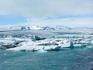
Esjufjöll
The subglacial Esjufjöll volcano is located at the SE part of the Vatnajökull icecap.
| Esjufjöll | |
|---|---|
 | |
| Highest point | |
| Elevation | 1,760 m (5,770 ft) |
| Coordinates | 64.27°N 16.65°W |
| Geography | |
| Location | Iceland, East Iceland |
| Geology | |
| Age of rock | Holocene |
| Mountain type | Stratovolcano |
| Last eruption | 1927? |
Geography
The mountains, actually nunataks within Vatnajökull, are located to the north of Öræfajökull volcano and of Jökulsárlón glacial lake.[1] The mountain range consists of 4 mountain massifs with three valleys in between them.[2]
The glaciers flowing around them are feeding Breiðamerkurjökull and in the end Jökulsárlón.[2]
Volcanism
Esjufjöll are a small volcanic system and as such part of Iceland's Oræfi Volcanic Belt. [3] Also part of this zone are Öræfajökull and Snæfell (north of Vatnajökull).[4]
The volcanic system consists of the Snaehetta central volcano with a large caldera. Most of the volcano, including the 40 km2 caldera, is covered by the icecap. On the other hand are parts of the SE flank exposed in NW-SE-trending ridges.[5] Most of the exposed rocks are mildly alkaline basalts, but one may also find small amounts of rhyolitic rocks.[5]
In the beginning of September 1927, a jökulhlaup came down the Jökulsá á Breiðamerkursandi. The glacier run was accompanied by a sulfur stench. On one occasion, ash fall on the Breiðamerkurjökull was thought to have possibly originated from Esjufjöll.[5] Although Holocene eruptions have not been confirmed from Esjufjöll, earthquake swarms that could indicate magma movements were detected in October 2002, and recently in October 2010.[5]
Mountaineering
Ari Trausti Guðmundsson proposes a mountaineering tour crossing Breiðamerkurjökull and up on Lyngbrekkutindur.[2]
See also
References
- Ísland Vegaatlas. Reykajvík (Ferðakort) 2006, p.7
- Ari Trausti Guðmundsson, Pétur Þorsteinsson: Íslensk fjöll. Gönguleiðir á 151 tind. Reykjavík 2004, p. 200.
- T. Thordarson, G. Larsen:Volcanism in Iceland in historical time. Volcano types, eruption types and eruption history. (2007)
- See eg.: Thor Thordarson, Armann Hoskuldsson: Classic geology in Europe 3. Iceland. Harpenden 2002, p. 14
- "Esjufjöll". Global Volcanism Program. Smithsonian Institution.
External links
- "Esjufjöll". Global Volcanism Program. Smithsonian Institution.
- Esjufjöll in the Catalogue of Icelandic Volcanoes