Erma Knoll
Erma Knoll (Bulgarian: Ерменска могила, romanized: Ermenska mogila, IPA: [ˈɛrmɛnskɐ moˈɡiɫɐ]) is a 412m peak in upper Huron Glacier, Livingston Island. The peak was first visited on 17 December 2004 by the Bulgarian Lyubomir Ivanov from Camp Academia, and was mapped by Bulgaria in 2005 and 2009 from the Tangra 2004/05 topographic survey. The knoll is named after Erma River in western Bulgaria.
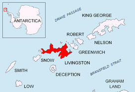
Location of Livingston Island in the South Shetland Islands
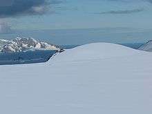
Erma Knoll from near Camp Academia, with McFarlane Strait and Greenwich Island in the background
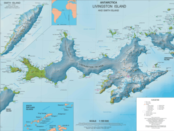
Topographic map of Livingston Island and Smith Island
Location
The knoll is located at 62°38′31″S 60°08′01″W which is 1.6 km east-southeast of Kuzman Knoll, 1.3 km northeast of Zograf Peak and 390 m northeast of Lozen Nunatak.
Maps
- L.L. Ivanov et al. Antarctica: Livingston Island and Greenwich Island, South Shetland Islands. Scale 1:100000 topographic map. Sofia: Antarctic Place-names Commission of Bulgaria, 2005.
- L.L. Ivanov. Antarctica: Livingston Island and Greenwich, Robert, Snow and Smith Islands. Scale 1:120000 topographic map. Troyan: Manfred Wörner Foundation, 2009.
gollark: no.
gollark: ... are there other markup syntaxes which are less awful to parse?
gollark: help
gollark: how do I markdown
gollark: Very tempted to make Markdown variant #19631871563 with simpler syntax.
References
- Erma Knoll. SCAR Composite Antarctic Gazetteer
- Bulgarian Antarctic Gazetteer. Antarctic Place-names Commission. (details in Bulgarian, basic data in English)
External links
- Erma Knoll. Copernix satellite image
This article includes information from the Antarctic Place-names Commission of Bulgaria which is used with permission.
This article is issued from Wikipedia. The text is licensed under Creative Commons - Attribution - Sharealike. Additional terms may apply for the media files.