Elzevir Creek
Elzevir Creek is a creek in the Moira River and Lake Ontario drainage basins in Tweed, Hastings County in Central Ontario, Canada.
| Elzevir Creek | |
|---|---|
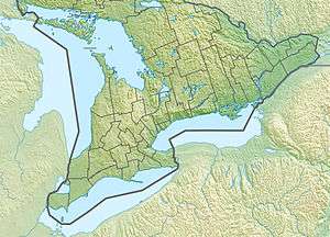 Location of the mouth of Elzevir Creek in southern Ontario | |
| Location | |
| Country | Canada |
| Province | Ontario |
| Region | Central Ontario |
| County | Hastings |
| Municipality | Tweed |
| Physical characteristics | |
| Source | Unnamed lake |
| • coordinates | 44°42′14″N 77°20′54″W |
| • elevation | 257 m (843 ft) |
| Mouth | Skootamatta River |
• coordinates | 44°33′57″N 77°19′12″W |
• elevation | 174 m (571 ft) |
| Basin features | |
| River system | Great Lakes Basin |
Course
Elzevir Creek begins at an unnamed lake, about 10 kilometres (6 mi) west of the community of Flinton, at an elevation of 257 metres (843 ft). It flows southeast into Elzevir Lake, then follows a circuitous route to reach its mouth at the Skootamatta River, just north of Highway 7, at the community of Actinolite and at an elevation of 174 metres (571 ft). The Skootamatta River flows via the Moira River into the Bay of Quinte on Lake Ontario at Belleville.
gollark: Mesh networking? Free WiFi locations? LoRaWAN?
gollark: And the majority of higher end GTech™ nanobots.
gollark: The protocol is basically JSON/msgpack over websocket so it could run on some microcontrollers.
gollark: Future versions are planned to be able to run task specific code for embedded-systemsy purposes I think.
gollark: And lets them be recategorised and renamed for purposes.
See also
References
- "Elzevir Creek". Geographical Names Data Base. Natural Resources Canada. Retrieved 2010-03-03.
- "Toporama - Topographic Map Sheet 31C11". Atlas of Canada. Natural Resources Canada. Archived from the original on 2010-08-31. Retrieved 2010-03-03.
This article is issued from Wikipedia. The text is licensed under Creative Commons - Attribution - Sharealike. Additional terms may apply for the media files.