Elsie, Kentucky
Elsie is an unincorporated community in Magoffin County, Kentucky, United States. It lies along U.S. Route 460 northwest of the city of Salyersville, the county seat of Magoffin County.[1] Its elevation is 850 feet (259 m).[2]
Elsie | |
|---|---|
| Nickname(s): Elsie lies along a stretch of the Linking River and is made up of Wolf Branch, Buck Branch, Cripple Creak, and Greasy Creak. | |
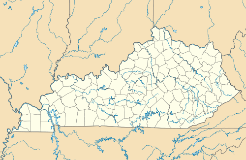 Elsie Location within the state of Kentucky  Elsie Elsie (the United States) | |
| Coordinates: 37°46′42″N 83°8′10″W | |
| Country | United States |
| State | Kentucky |
| County | Magoffin |
| Elevation | 850 ft (260 m) |
| Time zone | UTC-5 (Eastern (EST)) |
| • Summer (DST) | UTC-4 (EDT) |
| GNIS feature ID | 507935 |
A post office was established in Elsie in 1911, and named for the daughter of the first postmaster.[3]
References
- Rand McNally. The Road Atlas '06. Chicago: Rand McNally, 2006, p. 43.
- U.S. Geological Survey Geographic Names Information System: Elsie, Kentucky, Geographic Names Information System, 1979-09-20. Accessed 2008-01-03.
- Rennick, Robert M. (1987). Kentucky Place Names. University Press of Kentucky. p. 93. Retrieved 2013-04-28.
Municipalities and communities of Magoffin County, Kentucky, United States | ||
|---|---|---|
| City | 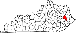 Location of Magoffin County, Kentucky | |
| Unincorporated communities | ||
This article is issued from Wikipedia. The text is licensed under Creative Commons - Attribution - Sharealike. Additional terms may apply for the media files.