El Tejar, Chimaltenango
El Tejar is a town, with a population of 15,639 (2018 census),[3] and a municipality in the Chimaltenango department of Guatemala.
El Tejar | |
|---|---|
Municipality and town | |
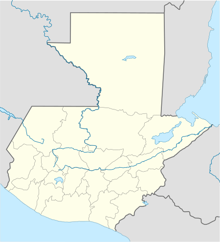 El Tejar Location in Guatemala | |
| Coordinates: 14°39′N 90°48′W | |
| Country | |
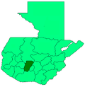
| Department | |
| Government | |
| • Major (2016-2020) | Juan José Cua Hernández[1] |
| Area | |
| • Total | 5.2 sq mi (13.5 km2) |
| Population (2018 census)[2] | |
| • Total | 19,492 |
| • Density | 3,700/sq mi (1,400/km2) |
| Time zone | UTC+6 (Central Time) |
| Climate | Cwb |
Economy
El Tejar was named for the tejas (roof tiles), bricks, and other pottery articles which are well known for their quality nationwide.
Climate
El Tejar has a subtropical highland climate (Köppen climate classification: Cwb).
| Climate data for El Tejar | |||||||||||||
|---|---|---|---|---|---|---|---|---|---|---|---|---|---|
| Month | Jan | Feb | Mar | Apr | May | Jun | Jul | Aug | Sep | Oct | Nov | Dec | Year |
| Average high °C (°F) | 22.2 (72.0) |
23.2 (73.8) |
24.9 (76.8) |
25.3 (77.5) |
25.1 (77.2) |
23.4 (74.1) |
23.6 (74.5) |
23.9 (75.0) |
23.3 (73.9) |
22.4 (72.3) |
22.5 (72.5) |
22.3 (72.1) |
23.5 (74.3) |
| Daily mean °C (°F) | 15.8 (60.4) |
16.5 (61.7) |
17.8 (64.0) |
19.0 (66.2) |
19.2 (66.6) |
18.7 (65.7) |
18.6 (65.5) |
18.5 (65.3) |
18.4 (65.1) |
17.5 (63.5) |
16.9 (62.4) |
15.9 (60.6) |
17.7 (63.9) |
| Average low °C (°F) | 9.4 (48.9) |
9.8 (49.6) |
10.7 (51.3) |
12.7 (54.9) |
13.4 (56.1) |
14.1 (57.4) |
13.6 (56.5) |
13.2 (55.8) |
13.5 (56.3) |
12.6 (54.7) |
11.3 (52.3) |
9.6 (49.3) |
12.0 (53.6) |
| Average precipitation mm (inches) | 3 (0.1) |
3 (0.1) |
3 (0.1) |
37 (1.5) |
106 (4.2) |
251 (9.9) |
184 (7.2) |
174 (6.9) |
236 (9.3) |
127 (5.0) |
31 (1.2) |
7 (0.3) |
1,162 (45.8) |
| Source: Climate-Data.org[4] | |||||||||||||
gollark: They *kind of* work, in that each page gets separate comments...]
gollark: Hmm, I wonder if floats work...
gollark: Soooo... exponential whatevers?
gollark: <@!113673208296636420> Any suggestions other than fiddling with thing length?
gollark: Wait, no, this is for *headers*. Hmm.
See also
- List of places in Guatemala
Places adjacent to El Tejar, Chimaltenango | ||||||||||
|---|---|---|---|---|---|---|---|---|---|---|
| ||||||||||
References
- "Partido UNE gana alcaldía de Chimaltenango". Prensa Libre (in Spanish). Guatemala. 8 September 2015. Retrieved 8 September 2015.CS1 maint: ref=harv (link)
- Citypopulation.de Population of departments and municipalities in Guatemala
- Citypopulation.de Population of cities & towns in Guatemala
- "Climate: El Tejar". Climate-Data.org. Retrieved 20 September 2015.
- SEGEPLAN (2010). "Municipios de Chimaltenango" (in Spanish). Guatemala. Archived from the original on 8 June 2015. Retrieved 8 June 2015.CS1 maint: ref=harv (link)
This article is issued from Wikipedia. The text is licensed under Creative Commons - Attribution - Sharealike. Additional terms may apply for the media files.