Ein Gedi (kibbutz)
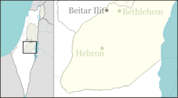
Ein Gedi (Hebrew: עֵין גֶּדִי, lit. Kid Spring) is a kibbutz on the western shore of the Dead Sea in Israel. Located on the edge of the Judean desert at the site of historic Ein Gedi, it falls under the jurisdiction of Tamar Regional Council. In 2018 it had a population of 603.[1]
Ein Gedi עֵין גֶּדִי | |
|---|---|
 Ein Gedi  Ein Gedi | |
| Coordinates: 31°27′30.96″N 35°23′19.68″E | |
| Country | |
| District | Southern |
| Council | Tamar |
| Affiliation | Kibbutz Movement |
| Founded | 1953 |
| Founded by | Zionist youth movements, Nahal |
| Population (2018)[1] | 603 |
| Website | www |
History
The kibbutz was founded in 1953.[2] It was named after the Biblical Ein Gedi, located on Tel Goren beside the kibbutz. Located on the edge of the Green Line separating Israel from the Jordanian-held West Bank, the kibbutz was completely isolated in the desert, the nearest Israeli village being several hours away via a dirt road. After the 1967 Six-Day War and Israel's capture of the West Bank from Jordan, a road was paved from Jerusalem via Jericho and along the shore of the Dead Sea. This essentially ended the kibbutz's isolation and opened the door to its development.
Climate
Ein Gedi has a hot desert climate (Köppen climate classification: BWh). The average annual temperature is 23.9 °C (75.0 °F), and around 107 mm (4.21 in) of precipitation falls annually.
| Climate data for Ein Gedi | |||||||||||||
|---|---|---|---|---|---|---|---|---|---|---|---|---|---|
| Month | Jan | Feb | Mar | Apr | May | Jun | Jul | Aug | Sep | Oct | Nov | Dec | Year |
| Average high °C (°F) | 20.4 (68.7) |
22 (72) |
25.5 (77.9) |
29.9 (85.8) |
34.4 (93.9) |
37 (99) |
38.3 (100.9) |
38.1 (100.6) |
35.9 (96.6) |
33.2 (91.8) |
28.4 (83.1) |
22.3 (72.1) |
30.5 (86.9) |
| Daily mean °C (°F) | 15.1 (59.2) |
16.2 (61.2) |
19.1 (66.4) |
22.9 (73.2) |
26.9 (80.4) |
29.6 (85.3) |
31 (88) |
31.3 (88.3) |
29.6 (85.3) |
26.6 (79.9) |
21.9 (71.4) |
16.8 (62.2) |
23.9 (75.1) |
| Average low °C (°F) | 9.8 (49.6) |
10.5 (50.9) |
12.7 (54.9) |
16 (61) |
19.5 (67.1) |
22.2 (72.0) |
23.8 (74.8) |
24.5 (76.1) |
23.3 (73.9) |
20.1 (68.2) |
15.4 (59.7) |
11.4 (52.5) |
17.4 (63.4) |
| Average precipitation mm (inches) | 26 (1.0) |
17 (0.7) |
15 (0.6) |
5 (0.2) |
2 (0.1) |
0 (0) |
0 (0) |
0 (0) |
0 (0) |
3 (0.1) |
15 (0.6) |
24 (0.9) |
107 (4.2) |
| Source: [3] | |||||||||||||
Economy

Ein Gedi is primarily involved with agriculture and tourism of the surrounding area and neighboring antiquities. In 1997, the kibbutz opened a facility to bottle the water of the Ein Gedi spring. The product is known as Ein Gedi Mineral Water. This led to controversy regarding the reselling of a public resource.
Botanical garden

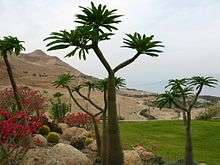
The kibbutz operates a 100 dunam (10 ha, 24.7 acre) botanical garden housing over 900 plant species from around the world. It is the only populated botanical garden in the world, with 500 residents.[4] The garden joined the register of the Botanic Gardens Conservation International in 1994, and today is recognized by the National Geographic Society as "the 11th wonder of the world." The garden includes date palms and Arecaceae, tropical and desert flora.[5]
References
- "Population in the Localities 2018" (XLS). Israel Central Bureau of Statistics. 25 August 2019. Retrieved 26 August 2019.
- Bar-Am, Aviva (26 January 2010). "Ein Gedi, a streamlined approach". The Jerusalem Post. Retrieved 25 April 2019.
- "Climate: Ein Gedi". September 2019.
- Dead Sea Ein Gedi Botanic Garden Botanic Gardens Conservation International
- Botanical garden thrives on the edge of the Dead Sea Travel with the Gardener