Egge (Lower Saxon Hills)
The Egge Hills (German: Eggegebirge, ![]()
| Egge Hills (Eggegebirge) | |
|---|---|
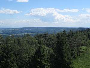 View from the Egge Tower on the Velmerstot looking south over the crest of the Egge Hills | |
| Highest point | |
| Peak | Preußische Velmerstot |
| Elevation | 468 m above NN |
| Dimensions | |
| Length | 50 km (31 mi) |
| Geography | |
 | |
| Country | Germany |
| Region | Höxter, Paderborn, Lippe, North Rhine-Westphalia |
| Range coordinates | 51°44′00″N 8°58′00″E |
| Parent range | Lower Saxon Hills |
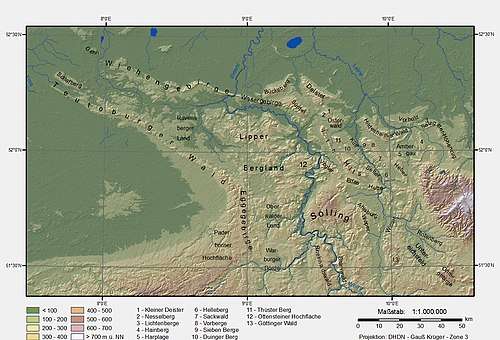
Geography
The Egge extends from the southern tip of the Teutoburg Forest range near Horn-Bad Meinberg and Steinheim, Westphalia southwards to the northern parts of the Sauerland near Marsberg. Its highest point is the Preußischer Velmerstot at an altitude of 468m. It is part of the Lower Saxon Hills and one of the two main lines of hills within the Teutoburg Forest / Egge Hills Nature Park.
It also constitutes part of the watershed between the rivers Rhine and Weser.
gollark: PotatOS emulates CraftOS, you know, for internal purposes.
gollark: Wow! Incredible!
gollark: Very little?
gollark: There are two advantages to tape FSes:extra spaceyou can play them to bleed ears
gollark: `libdatatape` already does most of the work for that.
External links
![]()

| Authority control |
|
|---|
This article is issued from Wikipedia. The text is licensed under Creative Commons - Attribution - Sharealike. Additional terms may apply for the media files.