Ebersdorf bei Coburg
Ebersdorf bei Coburg is a municipality in the district of Coburg in Bavaria in Germany.
Ebersdorf b.Coburg | |
|---|---|
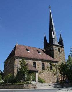 Protestant church | |
 Coat of arms | |
Location of Ebersdorf b.Coburg within Coburg district 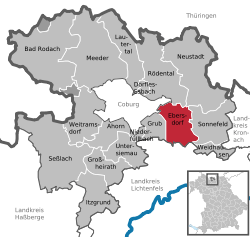 | |
 Ebersdorf b.Coburg  Ebersdorf b.Coburg | |
| Coordinates: 50°13′12″N 11°04′14″E | |
| Country | Germany |
| State | Bavaria |
| Admin. region | Oberfranken |
| District | Coburg |
| Subdivisions | 6 Ortsteile |
| Government | |
| • Mayor | Bernd Reisenweber |
| Area | |
| • Total | 26.50 km2 (10.23 sq mi) |
| Elevation | 310 m (1,020 ft) |
| Population (2018-12-31)[1] | |
| • Total | 6,017 |
| • Density | 230/km2 (590/sq mi) |
| Time zone | CET/CEST (UTC+1/+2) |
| Postal codes | 96237 |
| Dialling codes | 09562 |
| Vehicle registration | CO |
| Website | www.ebersdorf.de |
Geography
Location
Ebersdorf lies on the upper course of the river Füllbach, a tributary of the Itz, and at the northern edge of the Lichtenfels Forest (Lichtenfelser Forst).
Transport
Ebersdorf can be reached by car via motorway A 73 Suhl-Coburg-Nuremberg. Ebersdorf has a station at Eisenach–Lichtenfels railway. The Steinach Valley Railway from Ebersdorf to Neustadt bei Coburg has first been disrupted by the Inner German Border and was later lifted in 2000.
gollark: One is mostly green, the other is mostly yellow.
gollark: Oh, you want to know what it is? Demanding, but sure.
gollark: Okay, done.
gollark: Don't question it.
gollark: It's just the Cloud\™.
References
- "Fortschreibung des Bevölkerungsstandes". Bayerisches Landesamt für Statistik und Datenverarbeitung (in German). July 2019.
Towns and municipalities in Coburg (district) | ||
|---|---|---|
Coat of Arms of Coburg district | ||
| Authority control |
|
|---|
This article is issued from Wikipedia. The text is licensed under Creative Commons - Attribution - Sharealike. Additional terms may apply for the media files.