Dutch architecture in Semarang
During the colonial period many significant examples of Dutch architecture were built in Semarang, Indonesia.

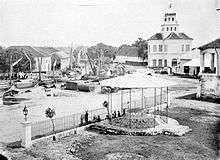
_in_Semarang_TMnr_10032316.jpg)
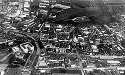
.jpg)
Control of Semarang was given to the Dutch East India Company (VOC) as a part of a debt payment by Sunan Amangkurat II in 1678 and established as area in 1682 Dutch. On 5 October 1705, Semarang officially became a VOC city when Susuhunan Pakubuwono I made a deal to give extensive trade rights to the VOC in exchange for wiping out Mataram's debt. The VOC, and later, the Dutch East Indies government, established tobacco plantations in the region and built roads and railroads, making Semarang an important colonial trading centre.
The presence of a Dutch based creole in the area is due to the fact that creole mix language called Javindo that developed.[1]
The Japanese military occupied the city, along with the rest of Java, in 1942, during the Pacific War of World War II. After Indonesian independence in 1945, Semarang became the capital of Central Java province.
City planning of Semarang during Dutch colonial era
The era of Classical Indische Town (1678–1870)
The city included a Muslim area called Kauman, a Chinese quarter, and a Dutch fortress. The fortress had a pentagonal form with only one gate in the south and five monitoring towers to protect the Dutch settlement from rebellion actions, segregating the spaces between Dutch settlement and other areas.[2] The Dutch quarter was considered the city of Semarang by the Dutch while the other ethnic settlements were considered as villages outside the city boundary.
Known as de Europeeshe Buurt, Semarang was built in classical European style with a church located in the centre, wide boulevards and streets skirted by beautiful villas.[3] According to Purwanto (2005),[4] the urban and architectural form of this settlement is very similar to the design principles applied in many Dutch cities and consideration of urban beautification.
Due to the long and costly Java War, there was not much of funding from the Dutch East Indies government for the development of Semarang. The majority of land was used for rice fields and the only small improvements were made around the fortress.
Although less populous than Jakarta and Surabaya, Semarang is a planned city with urban activities concentrated along the river. The settlement was linked to a market where different ethnic groups met to trade. The existence of the market, in the later years, become a primary element and a generator of urban economic growth.[5]
An important influence on urban growth was the Great Mail Road project in 1847, which connected all the cities in northern coast of Central and East Java and made Semarang the trade centre of agricultural production.[6] The project was soon followed by the development of the Netherlands Indies Railway and the connecting roads into the inner city of Semarang at the end of 19th century.[5] Colombijn (2002)[6] This marked the development as the shift of urban functions, from the former river orientation to facing the roads.
The growth of the modern city (1870–1922)

Improved communication, as the result of the Mail and Railway projects, had brought an economic booming for the city in the 1870s. There were hospital, churches, hotels, and large houses built along the new main roads; Bojongscheweg, Pontjolscheweg, and Mataram street, causing denser population in the ethnic settlements and creating the urban kampong.[3]
Urban growth had made acutely dense the urban kampong, reaching the number of 1000 inhabitants per hectare and degrading the quality of living condition.[7] In this early 20th century, mortality rate was very high due to the overcrowding and lack of hygiene that triggered the invasion of cholera and tuberculosis.[8] Cobban (1993)[7] noted the ethical movement of kampongverbetering led by Henry Tillema in 1913 and the concern of the Advisor for Decentralisation for kampong improvement through the betterment of public toilets, drainage, and the planning of public housing.
In 1917, a healthy housing project was implemented in the Southern part of Semarang called Candi Baru. Thomas Karsten, the advisor for city planning, transformed the concept of ethnic segregation that divided previous urban settlements into a new housing district plan based on economic classes. Although practically the three ethnic groups were also divided into three economic classes where the Dutch and rich Chinese occupied the largest lots in the housing district,[3] Karsten had effectively emerged the developed district by integrating the road network, introducing newly improved public wash and bathing, squares and sporting facilities that can be utilised communally.[9] Following the Candi Baru, there were three other housing plans between 1916–1919 to accommodate 55% population increase in Semarang; 45,000 Javanese, 8500 Chinese and 7000 Europeans. Karsten marked a new approach to town planning which emphasis on the aesthetic, practical and social requirements, articulated not in terms of racial terms but economic zones.[9]
Driven by economic growth and spatial city planning, the city had doubled in size and expanded to the south by the 1920s, creating a nucleus of a metropolis where multi-ethnic groups lived and traded in the city. The villages in the suburbs such as Jomblang and Jatingaleh steadily became the satellite towns of Semarang, more populated with a bigger market area. Before the invasion of Japan in 1942, Semarang had already become the capital of Central Java Province, as the result of trade and industrial success and spatial planning.[3]
Buildings
Significant buildings include:
- NIS Headquarters (now Lawang Sewu)
- Nillmij Office Building
- Villa Bodjong Gimberg
- Semarang Residency House
- Semarang Tawang Station
- "Generaalswoning"
Gallery
 Residency House in Semarang (19th century)
 Semarang Tawang train station of the NIS
 Waiting room of the Semarang Tawang train station
.jpg) "Woonhuis" designed by Edwin Landseer Lutyens
"Woonhuis" designed by Edwin Landseer Lutyens Villa Bodjong Gimberg
 Heerenstraat (Lords Street)
 Houses
 "Generaalswoning"
References
- De Gruiter, Miel. "Javindo, a contact language in pre-war Semarang". (Peter Bakker & Maarten Mous. Mixed Languages: 15 Case Studies in Language Intertwining. Amsterdam: IFOTT. 1994.) pp. 151–159.
- Purwanto, L. M. F. (2005). Kota Kolonial Lama Semarang. Dimensi Teknik Arsitektur, 33(1), 27-33
- Pratiwo. (2005). The City Planning of Semarang 1900–1970. In F. Colombijn, M. Barwegen, P. Basundoro & J. A. Khusyairi (Eds.), Old City, New City: The History of the Indonesian City Before and After Independence. Yogyakarta: Penerbit Ombak.
- Purwanto, L. M. F. (2005). Kota Kolonial Lama Semarang. Dimensi Teknik Arsitektur, 33(1), 27-33.
- Nas, P. J. M., & Pratiwo. (2002). Java and De Groote Postweg, La Grande Route, the Great Mail Road, Jalan Raya Pos’. Bijdragen tot de Taal-, Land-en Volkenkunde, 158(4), 707–725.
- Colombijn, F. (2002). Introduction; On the road. Bijdragen tot de Taal-, Land-en Volkenkunde, 158(4), 595-617.
- Cobban, J. L. (1993). Public Housing in Colonial Indonesia 1900–1940. Modern Asian Studies, 27(04), 871-896.
- Silver, C. (2008). Planning the megacity: Jakarta in the twentieth century: Psychology Press.
- Cote, J. (2004). Colonial designs: Thomas Karsten and the planning of urban Indonesia. Imprint, 2004, 01-01.