Dryden, Washington
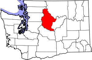
Dryden is a small unincorporated community in Chelan County, Washington, United States. It is situated along the Wenatchee River in the fertile Wenatchee Valley between the towns of Cashmere and Leavenworth. The community serves as a supply and shipping point for local farms and orchards.
Dryden is part of the Wenatchee–East Wenatchee Metropolitan Statistical Area.
The USPS ZIP Code for Dryden is 98821. According to data from the 2000 census, the total population in the Dryden ZIP code was 243 persons occupying 101 housing units. Dryden itself is not incorporated, and is not tracked by the Census.
History
The area that is now Dryden was historically called Pine Flat by local ranchers because of the large Pine trees growing in the area. In the 1890s these trees were logged and floated down the Wenatchee River to be milled, leaving the land barren and dry. Also in 1892, the Great Northern Railway built its main line through the valley but no town or station were established at that time. Only the name Dryden was assigned to the area by the railroad in honor of Canadian horticulturist and Minister of Agriculture John Dryden who toured with Great Northern Railway president James J. Hill.[1] Native American homesteaders Dan and Topen Nason were the first to see any value in the then undeveloped area and filed a land claim in 1904. Other settlers soon followed with the intent of planting orchards, specifically apple trees. The land was cut into small tracts which were quickly sold.[2]
The Dryden Fruit Growers Union was incorporated in 1909 and the first fruit warehouse was constructed. That same year 18 railroad cars of apples were shipped out. The next year a post office was established for the small settlement growing by the warehouse. Orchard planting greatly escalated with the completion of the Icicle Canal in 1913. By 1915, the railroad had established a station at Dryden and by 1919, the town had its own bank and school as well as two churches.[2] Currently, Dryden retains a post office, a general store, a tienda, and a small cafe called the Take A Break Cafe which has been a cafe consistently since the early 1930s.
Climate
This climatic region is typified by large seasonal temperature differences, with warm to hot (and often humid) summers and cold (sometimes severely cold) winters. According to the Köppen Climate Classification system, Dryden has a humid continental climate, abbreviated "Dfb" on climate maps.[3]
References
- Phillips, James W. Washington State Place Names. 8th ed. Seattle: University of Washington Press, 1971. Print.
- Hull, Lindley M. (editor)A History of Central Washington: Including the Famous Wenatchee, Entiat, Chelan and the Columbia Valleys, with an Indexed Eighty Scenic Historical Illustrations. Spokane, WA: Shaw & Borden Company, 1929. Print.
- Climate Summary for Dryden, Washington
