Drake County

Drake County is one of the 141 Cadastral divisions of New South Wales.

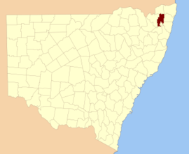
Drake
New South Wales
Location in New South Wales
Lands administrative divisions around Drake:
Buller Buller Rous
Clive Drake Richmond
Gough Gresham Clarence

Drake County was named in honour of Sir Francis Drake (1540–1596).[1] It is located to the north of parts of the Clarence River, Nymboida River and Mann River. It includes the Washpool National Park.

Parishes within this county

A full list of parishes found within this county; their current LGA and mapping coordinates to the approximate centre of each location is as follows:

ParishLGACoordinates
AlbertGlen Innes Severn Council29°23′54″S 152°21′04″E
AliceClarence Valley Council29°02′54″S 152°38′04″E
Black CampKyogle Council28°48′54″S 152°43′04″E
CangaiClarence Valley Council29°36′54″S 152°30′04″E
CarnhamClarence Valley Council29°16′54″S 152°30′04″E
ChauvelTenterfield Shire Council28°55′54″S 152°32′04″E
ChurchillClarence Valley Council29°10′54″S 152°30′04″E
CoombadjhaClarence Valley Council29°22′54″S 152°28′04″E
CoongbarClarence Valley Council29°04′54″S 152°42′04″E
CooraldooralGlen Innes Severn Council29°34′54″S 152°16′04″E
DandahraClarence Valley Council29°29′54″S 152°26′04″E
DrakeTenterfield Shire Council29°00′54″S 152°25′04″E
DunbarTenterfield Shire Council28°57′54″S 152°31′04″E
EwingarClarence Valley Council29°05′54″S 152°30′04″E
FairfieldTenterfield Shire Council28°54′54″S 152°27′04″E
HamiltonTenterfield Shire Council29°01′54″S 152°30′04″E
HassanClarence Valley Council29°20′54″S 152°45′04″E
HongkongTenterfield Shire Council29°06′54″S 152°24′04″E
KeybarbinClarence Valley Council29°06′54″S 152°38′04″E
MalaraTenterfield Shire Council29°12′54″S 152°22′04″E
MookimaClarence Valley Council29°14′54″S 152°43′04″E
NevilleClarence Valley Council29°15′54″S 152°46′04″E
OgilvieClarence Valley Council29°11′54″S 152°38′04″E
PicarbinKyogle Council28°57′54″S 152°36′04″E
PikapeneKyogle Council28°58′54″S 152°42′04″E
PlevnaClarence Valley Council29°17′54″S 152°22′04″E
PuckaClarence Valley Council29°20′54″S 152°35′04″E
PuhoiClarence Valley Council29°35′54″S 152°24′04″E
PulganbarClarence Valley Council29°26′54″S 152°41′04″E
RichmondGlen Innes Severn Council29°29′54″S 152°21′04″E
RodgersGlen Innes Severn Council29°38′54″S 152°14′04″E
RodhamClarence Valley Council29°09′54″S 152°43′04″E
SandilandsKyogle Council28°54′54″S 152°42′04″E
SistovaTenterfield Shire Council29°13′54″S 152°16′04″E
TabulamKyogle Council28°52′54″S 152°37′04″E
TimbarraTenterfield Shire Council28°52′54″S 152°30′04″E
West FairfieldTenterfield Shire Council28°55′54″S 152°22′04″E
YarrcalkiarraClarence Valley Council29°16′54″S 152°39′04″E
YulgilbarClarence Valley Council29°16′54″S 152°34′04″E
gollark: Did you `systemctl enable` it?
gollark: There was a slight file descriptor leak.
gollark: Did you compile the latest version?
gollark: Very slight differences in function post-reboot I think.
gollark: I rebooted it slightly before rebooting osmarks.net a while ago.

References

  1. "Drake". Geographical Names Register (GNR) of NSW. Geographical Names Board of New South Wales. Retrieved 4 August 2013.
This article is issued from Wikipedia. The text is licensed under Creative Commons - Attribution - Sharealike. Additional terms may apply for the media files.