Draga, Šmarješke Toplice
Draga (pronounced [ˈdɾaːɡa]) is a small settlement in the Municipality of Šmarješke Toplice in southeastern Slovenia. It lies on the left bank of the Krka River east of Bela Cerkev. The area is part of the historical region of Lower Carniola. The municipality is now included in the Southeast Slovenia Statistical Region.[2]
Draga | |
|---|---|
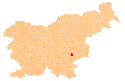
 Draga Location in Slovenia | |
| Coordinates: 45°52′15.5″N 15°16′58.74″E | |
| Country | |
| Traditional region | Lower Carniola |
| Statistical region | Southeast Slovenia |
| Municipality | Šmarješke Toplice |
| Area | |
| • Total | 0.24 km2 (0.09 sq mi) |
| Elevation | 165.8 m (544.0 ft) |
| Population (2002) | |
| • Total | 14 |
| [1] | |
Name
The name Draga is derived from the Slovene common noun draga 'small, narrow valley', which refers to the geographical location of the settlement.[3]
Church
The local church is dedicated to Saint Helena and belongs to the Parish of Bela Cerkev. It was first mentioned in written documents dating to 1531. It was renovated in the Baroque style in the 18th century.[4]
gollark: This aeon has a word code.https://dragcave.net/lineage/83FEe
gollark: https://dragcave.net/lineage/bUNDNAeon with coolish code.
gollark: I would like it more if there were two blue omens, for balance.
gollark: It's 4G from 4 alt Wyrmomens.
gollark: https://dragcave.net/lineage/TDJH9What should I call this?
References
- Statistical Office of the Republic of Slovenia
- Šmarješke Toplice municipal site
- Snoj, Marko (2009). Etimološki slovar slovenskih zemljepisnih imen. Ljubljana: Modrijan. p. 120.
- "EŠD 1624". Registry of Immovable Cultural Heritage (in Slovenian). Ministry of Culture of the Republic of Slovenia. Retrieved 24 May 2011.
External links
| Settlements | Administrative centre: Šmarješke Toplice
|  | ||||
|---|---|---|---|---|---|---|
| Landmarks |
| |||||
This article is issued from Wikipedia. The text is licensed under Creative Commons - Attribution - Sharealike. Additional terms may apply for the media files.