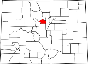
Downieville, Colorado
Downieville is a small unincorporated community situated along Clear Creek in Clear Creek County, Colorado, United States. Downieville is a part of the Downieville-Lawson-Dumont census-designated place.
Downieville, Colorado | |
|---|---|
 Downieville, Colorado Location within the state of Colorado | |
| Coordinates: 39°46′1″N 105°36′54″W | |
| Country | |
| State | |
| County | Clear Creek County[1] |
| Elevation | 8,031 ft (2,448 m) |
| Time zone | UTC-7 (MST) |
| • Summer (DST) | UTC-6 (MDT) |
| ZIP code | Dumont CO 80436 |
| Area code(s) | Both 303 and 720 |
Geography
Downieville is located at 39°46′1″N 105°36′54″W (39.766927,-105.615124).
gollark: The entity scanner.
gollark: You do, in fact, need to convert booleans into other types when using them in some ways.
gollark: I think that's doable.
gollark: Hmm, maybe I should make potatOS automatically cast booleans to random numbers.
gollark: `pcall` returns `true`/`false` as its first return value.
See also
- Denver-Aurora Metropolitan Statistical Area
- Denver-Aurora-Boulder Combined Statistical Area
- Front Range Urban Corridor
- List of cities and towns in Colorado
References
- "US Board on Geographic Names". United States Geological Survey. 2007-10-25. Retrieved 2008-01-31.
This article is issued from Wikipedia. The text is licensed under Creative Commons - Attribution - Sharealike. Additional terms may apply for the media files.
