Dourdou de Conques
The Dourdou de Conques is an 83.7 km (52.0 mi) long river in the department of Aveyron, southern France.[1] Its source is near the village of Lassouts. It flows generally west. It is a left tributary of the Lot, into which it flows near Grand-Vabre.
| Dourdou de Conques | |
|---|---|
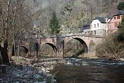 Old bridge in Conques | |
| Location | |
| Country | France |
| Physical characteristics | |
| Source | |
| • location | in Lassouts |
| • coordinates | 44.4872°N 2.8577°E |
| Mouth | |
• location | Lot |
• coordinates | 44.6357°N 2.3532°E |
| Length | 83.7 km (52.0 mi) |
| Basin size | 601 km2 (232 sq mi) |
| Basin features | |
| Progression | Lot→ Garonne→ Gironde estuary→ Atlantic Ocean |
Communes along its course
The following list is ordered from source to mouth:
- Aveyron: Lassouts, Palmas-d'Aveyron, Gabriac, Bozouls, Rodelle, Muret-le-Château, Villecomtal, Pruines, Mouret, Nauviale, Conques-en-Rouergue
gollark: Personally I'd say I lean slightly more "markets" than the test says, but meh.
gollark: Libertarian isn't "no government", it's "smallish government".
gollark: I redid it now.
gollark: I can't find my results so I'll just do it again.
gollark: A JS operator.
This article is issued from Wikipedia. The text is licensed under Creative Commons - Attribution - Sharealike. Additional terms may apply for the media files.