Domnovo
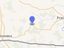
Domnovo (Russian: До́мново; German: Domnau; Polish: Domnowo; Lithuanian: Dumnava) is a rural locality (a settlement) in Pravdinsky District of Kaliningrad Oblast, Russia, located near the Poland–Russia border, about 40 kilometers (25 mi) southeast of Kaliningrad, the administrative center of the oblast, and 12 kilometers (7.5 mi) west of Pravdinsk, the administrative center of the district. Population: 820 (2010 Census.[1]
Domnovo Домново | |
|---|---|
Settlement | |
Location of Domnovo 
| |
 Domnovo Location of Domnovo  Domnovo Domnovo (Kaliningrad Oblast) | |
| Coordinates: 54°26′N 20°50′E | |
| Country | Russia |
| Federal subject | Kaliningrad Oblast |
| Administrative district | Pravdinsky District |
| Rural okrug | Domnovsky Rural Okrug |
| Founded | 1300 |
| Elevation | 76 m (249 ft) |
| Population | |
| • Total | 820 |
| Time zone | UTC+2 (MSK–1 |
| Postal code(s)[3] | 238404 |
| Dialing code(s) | +7 40157 |
| OKTMO ID | 27719000431 |

History
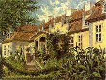
Before 1945 the area belonged to Germany as part of Landkreis Bartenstein in the Province of East Prussia. German settlers arrived in the area probably during the 13th century and c. 1300 the Teutonic Order erected a castle (Ordensburg) to protect a crossroad here. The castle was largely destroyed probably already in 1458, but still partially inhabited in 1474 and in the 19th century its cellar vaults were discovered adjacent to the town church. The town, a so-called lischke, grew up around the castle. A church and a school existed at least from 1319, and from 1437 the town had city rights. In 1469 the town became the fief of the knight Konrad von Egloffstein, who built a palace on an island in a lake south of the town. The palace was rebuilt during the 16th century and again in 1778. Caspar Hennenberger served as a priest in the town from 1554 to 1560. The town suffered destruction from fires on several occasions: in 1520, 1571, 1659, 1681 and 1776. In addition, around 60 percent of the town was destroyed in fighting during World War I (later rebuilt). A railway connection was built to the town in 1902.[4]
After World War II the region was placed under Soviet administration according to the post-war Potsdam Agreement.
Notable residents
- Andreas von Kreytzen (1579-1641)
- Georg Weissel (1590-1635), poet
- Arnold Lyongrün (1871-1935), artist
- Walter Krupinski (1920-2000), Luftwaffe general
References
- Kaliningradstat. 2010 Census Results Archived 2013-11-28 at WebCite
- "Об исчислении времени". Официальный интернет-портал правовой информации (in Russian). 3 June 2011. Retrieved 19 January 2019.
- Почта России. Информационно-вычислительный центр ОАСУ РПО. (Russian Post). Поиск объектов почтовой связи (Postal Objects Search) (in Russian)
- Weise, Erich, ed. (1981) [1966]. Handbuch der historischen Stätten. Ost- und Westpreussen (in German). Stuttgart: Kröner. pp. 40–41. ISBN 3-520-31701-X.