Dobrova, Celje
Dobrova (pronounced [ˈdoːbɾɔʋa]) is a settlement in the City Municipality of Celje in eastern Slovenia. It lies on the northern outskirts of the town of Celje. The area was traditionally part of the Styria region. It is now included in the Savinja Statistical Region.[2]
Dobrova Zgornja Dobrova (until 1982) | |
|---|---|
 Dobrova Location in Slovenia | |
| Coordinates: 46°16′7.08″N 15°15′34.59″E | |
| Country | |
| Traditional region | Styria |
| Statistical region | Savinja |
| Municipality | Celje |
| Area | |
| • Total | 1.36 km2 (0.53 sq mi) |
| Elevation | 262.9 m (862.5 ft) |
| Population (2002) | |
| • Total | 191 |
| [1] | |
Name
The name of the settlement was changed from Zgornja Dobrova to Dobrova in 1982.[3]
gollark: <@!319753218592866315> Admit it.
gollark: What if #1 is actually LyricLy pretending to be Olivia?
gollark: Yes, compression ratios are better than gzip.
gollark: If you sample your analysis from a uniform distribution, it provides no information to the writers.
gollark: Well, the obvious solution is lies.
References
- Statistical Office of the Republic of Slovenia
- Celje municipal site
- Spremembe naselij 1948–95. 1996. Database. Ljubljana: Geografski inštitut ZRC SAZU, DZS.
External links
| Administrative center | 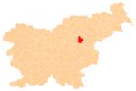 The location of the City Municipality of Celje 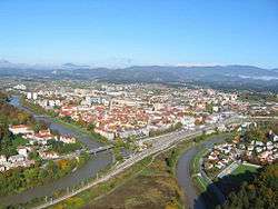 View of Celje from Celje Castle | |
|---|---|---|
| Districts | ||
| Landmarks |
| |
| Local communities |
| |
| Settlements outside the urban center |
| |
| Former settlements |
| |
| Culture | ||
| Notable people |
| |
This article is issued from Wikipedia. The text is licensed under Creative Commons - Attribution - Sharealike. Additional terms may apply for the media files.