Dobong District
Dobong District (도봉구, Dobong-gu) is one of the 25 districts of Seoul, South Korea.
Dobong 도봉구 | |
|---|---|
| 도봉구 · 道峰區 | |
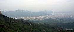
 Skyline of Dobong District (left side) | |
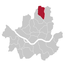
 Location of Dobong-gu in Seoul | |
| Coordinates: 37°41′42″N 127°02′49″E | |
| Country | South Korea |
| Region | Sudogwon |
| Special City | Seoul |
| Administrative dong | 14 |
| Government | |
| • Mayor | Lee dong-jin (이동진) |
| Area | |
| • Total | 20.8 km2 (8.0 sq mi) |
| Population (2010[1]) | |
| • Total | 348,625 |
| • Density | 17,000/km2 (43,000/sq mi) |
| Time zone | UTC+9 (Korea Standard Time) |
| Postal code | 01300~01599 |
| Area code | 02-9xx,2000~ |
| Website | Dobong-gu official website |
Dobong has a population of 348,625 (2010) and has a geographic area of 20.8 km2 (8 sq mi), and is divided into 4 dong (administrative neighborhoods). The district is located in northeastern Seoul, bordering the Gyeonggi Province cities of Yangju and Uijeongbu to the north, and the Seoul city districts of Gangbuk to the southwest and Nowon to the east.
Mountain
Dobongsan Mountain is a mountain in Bukhansan National Park, partly under the jurisdiction of Dobong-gu. It is a popular leisure spot for district residents.
In addition, Dobongsan Mountain has many large and small temples such as Cheonchuksa, Wontongsa, and Manweolam.[2]
Administrative divisions

Administrative divisions
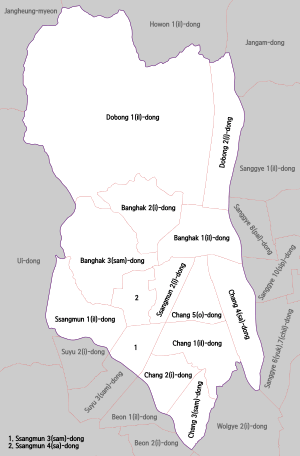
Dobong-gu is composed of four dong.
- Dobong-dong (도봉동 道峰洞) 1, 2
- Banghak-dong (방학동 放鶴洞) 1, 2, 3
- Ssangmun-dong (쌍문동 雙門洞) 1, 2, 3, 4
- Chang-dong (창동 倉洞) 1, 2, 3, 4, 5
Transportation
Railroad
- Korail
- Seoul Metro
- Seoul Subway Line 4
- (Nowon-gu) ← Chang-dong — Ssangmun → (Gangbuk-gu)
- Seoul Subway Line 4
- Seoul Metropolitan Rapid Transit Corporation
Sister cities


gollark: Interesting! What happens if you make an AI which gains a soul, and then copy its code onto a thousand other computers running it, or something?
gollark: ↑
gollark: * for the
gollark: Oh, the for thingy which allegedly listens to spirits, right.
gollark: That sure is a thing of some kind.
References
External links
| Wikimedia Commons has media related to Dobong-gu, Seoul. |
- Official site (in Korean)
- Official site (in English)
This article is issued from Wikipedia. The text is licensed under Creative Commons - Attribution - Sharealike. Additional terms may apply for the media files.
