Dioulatièdougou
Dioulatièdougou is a town in north-western Ivory Coast. It is a sub-prefecture and commune of Odienné Department in Kabadougou Region, Denguélé District. The border of Woroba District is nearby to the southeast.
Dioulatièdougou | |
|---|---|
Town, sub-prefecture, and commune | |
 Dioulatièdougou Location in Ivory Coast | |
| Coordinates: 8°58′N 7°14′W | |
| Country | |
| District | Denguélé |
| Region | Kabadougou |
| Department | Odienné |
| Population (2014)[1] | |
| • Total | 8,028 |
| Time zone | UTC+0 (GMT) |
In 2014, the population of the sub-prefecture of Dioulatièdougou was 8,028[2].
Villages
The 15 villages of the sub-prefecture of Dioulatièdougou and their population in 2014 are[2]:
- Dagaba (78)
- Dioulatiedougou (1 410)
- Doumba (288)
- Tiékorodougou (581)
- Bogoba (505)
- Farako (810)
- Kobala (128)
- Kougbeni (265)
- Massadougou (518)
- Nafanasienso (954)
- Nienesso (443)
- Sanankoroba (269)
- Tindikoro (843)
- Tindikorosokoula (400)
- Zandougou (536)
gollark: <:pbanj:486393042811748359>
gollark: <:pbanj:445016914125783043>
gollark: <:Tohnkfast:445017963918131220> <:Tohnk:445016844223381526> <:Thonkdown:433149076721238016> <:Thonk:445016973798014987> <:thinkingNoose:486392616800485387> <:pbanj:486393042811748359> <<:pbanj:486393042811748359>445016914125783043> <:ninja:445055784057962497> <:insane:455119246310244362> <:chips:453465151132139521> <:blobaww:445018244689035265> <:blobangry:445017002575265812>
gollark: !!???
gollark: Rúst ≥ C.
References
- "Côte d'Ivoire". geohive.com. Retrieved 8 December 2015.
- "RGPH 2014, Répertoire des localités, Région Kabadougou" (PDF). ins.ci. Retrieved 5 August 2019.
Regional seat: Odienné | ||
| Gbéléban Department | 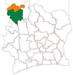 | |
| Madinani Department | ||
| Odienné Department | ||
| Samatiguila Department | ||
| Séguélon Department | ||
* also a commune | ||
This article is issued from Wikipedia. The text is licensed under Creative Commons - Attribution - Sharealike. Additional terms may apply for the media files.