Dianra
Dianra is a town in north-western Ivory Coast. It is a sub-prefecture of and the seat of Dianra Department in Béré Region, Woroba District. Dianra is also a commune. In 2014, the population of the sub-prefecture of Dianra was 53,700 [2].
Dianra | |
|---|---|
Town, sub-prefecture, and commune | |
 Dianra Location in Ivory Coast | |
| Coordinates: 8°46′N 6°15′W | |
| Country | |
| District | Woroba |
| Region | Béré |
| Department | Dianra |
| Population (2014)[1] | |
| • Total | 53,700 |
| Time zone | UTC+0 (GMT) |
Villages
The twenty four villages of the sub-prefecture of Dianra and their population in 2014 are [2]: {{Columns-list|colwidth=22em|
- Cissédougou (302)
- Dalagbè (1 451)
- Dianra (25 880)
- Diarradougou (432)
- Diembé (575)
- Fila-Faraba (831)
- Gbatosso (2 055)
- Gbondiélé (1 016)
- Gbongougo 1 (127)
- Gbongougo 2 (138)
- Gominasso (2 947)
- Katiali (719)
- Korotou (682)
- Lalogo (5 318)
- Lenguédougou (1 205)
- Locolo (2 147)
- Manadougou (337)
- Niondje (576)
- Ouahiéré (1 886)
- Samoukaha (1 608)
- Séfigué (1 153)
- Sienkounon (324)
- Solifono (843)
- Yérétiélé (1 148)
Notes
- "Côte d'Ivoire". geohive.com. Retrieved 14 December 2015.
- "RGPH 2014, Répertoire des localités, Région Béré" (PDF). ins.ci. Retrieved 5 August 2019.
Regional seat: Mankono | ||
| Dianra Department | 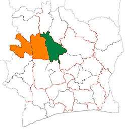 | |
| Kounahiri Department | ||
| Mankono Department | ||
* also a commune | ||
gollark: !pingwhen online <@!258639553357676545> Rust.
gollark: !pingwhen online <@!258639553357676545> Rust.
gollark: !pingwhen online <@!258639553357676545> Rust.
gollark: !pingwhen online <@!258639553357676545> Rust.
gollark: !pingwhen online <@!258639553357676545> Rust.
This article is issued from Wikipedia. The text is licensed under Creative Commons - Attribution - Sharealike. Additional terms may apply for the media files.