Devola, Ohio
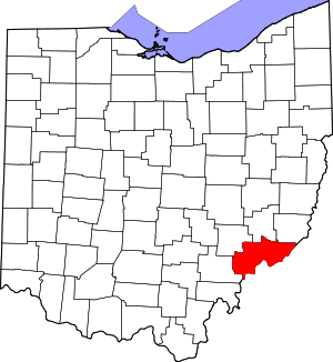
Devola is a census-designated place (CDP) in Washington County, Ohio, United States, along the Muskingum River. It is part of the Parkersburg-Marietta-Vienna, WV-OH Metropolitan Statistical Area. The population was 2,771 at the 2000 census.
Devola, Ohio | |
|---|---|
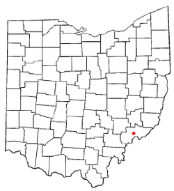
 Location of Devola, Ohio | |
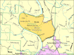
 Detailed map of Devola | |
| Coordinates: 39°28′13″N 81°28′22″W | |
| Country | United States |
| State | Ohio |
| County | Washington |
| Area | |
| • Total | 5.4 sq mi (13.9 km2) |
| • Land | 5.1 sq mi (13.3 km2) |
| • Water | 0.2 sq mi (0.6 km2) |
| Elevation | 682 ft (208 m) |
| Population (2000) | |
| • Total | 2,771 |
| • Density | 539.9/sq mi (208.5/km2) |
| Time zone | UTC-5 (Eastern (EST)) |
| • Summer (DST) | UTC-4 (EDT) |
| FIPS code | 39-21868[2] |
| GNIS feature ID | 1085460[1] |
History
The community was named for the local Devol family.[3] Captain Devol built a mill in 1807 at Devol's Dam.[4] A post office called Devols Dam was established in 1881, and remained in operation until 1890.[5]
Geography
Devola is located at 39°28′13″N 81°28′22″W (39.470334, -81.472759).[6]
According to the United States Census Bureau, the CDP has a total area of 5.4 square miles (14 km2), of which 5.1 square miles (13 km2) is land and 0.2 square miles (0.52 km2) (4.10%) is water.
Education
Devola has one school local to the region, Putnam Elementary School. The school only supports students from Kindergarten to Grade 5. The Putnam Elementary School is a public school that belongs to the Marietta City School District, providing a school to 244 students.[7] Further education is available in nearby towns, especially Williamstown hosting an array of colleges and schools such as:
- Marietta College
- Marietta Middle School
- Williamstown High School
Demographics
At the 2000 census there were 2,771 people, 1,065 households, and 803 families living in the CDP. The population density was 539.9 people per square mile (208.6/km²). There were 1,136 housing units at an average density of 221.4/sq mi (85.5/km²). The racial makeup of the CDP was 97.58% White, 0.07% African American, 1.88% Asian, 0.07% from other races, and 0.40% from two or more races. Hispanic or Latino of any race were 0.11%.[2]
Of the 1,065 households 28.6% had children under the age of 18 living with them, 68.2% were married couples living together, 6.3% had a female householder with no husband present, and 24.6% were non-families. 22.1% of households were one person and 12.2% were one person aged 65 or older. The average household size was 2.46 and the average family size was 2.88.
The age distribution was 22.4% under the age of 18, 6.1% from 18 to 24, 22.4% from 25 to 44, 26.9% from 45 to 64, and 22.2% 65 or older. The median age was 44 years. For every 100 females there were 93.1 males. For every 100 females age 18 and over, there were 88.3 males.
The median household income was $48,558 and the median family income was $58,214. Males had a median income of $39,028 versus $26,833 for females. The per capita income for the CDP was $24,751. About 3.4% of families and 4.5% of the population were below the poverty line, including 7.8% of those under age 18 and 4.8% of those age 65 or over.
References
- "US Board on Geographic Names". United States Geological Survey. 2007-10-25. Retrieved 2008-01-31.
- "U.S. Census website". United States Census Bureau. Retrieved 2008-01-31.
- U.S. Geological Survey Geographic Names Information System: Devola, Ohio
- Hathaway, Seymour J. (1902). History of Marietta and Washington County, Ohio, and Representative Citizens. Biographical Publishing Company. p. 316.
- "Washington County". Jim Forte Postal History. Archived from the original on 18 January 2016. Retrieved 29 December 2015.
- "US Gazetteer files: 2010, 2000, and 1990". United States Census Bureau. 2011-02-12. Retrieved 2011-04-23.
- "Explore Putnam Elementary School in Marietta, OH". GreatSchools.org. Retrieved 2020-07-16.
