Devils Mountain Lodge Airport
Devils Mountain Lodge Airport (ICAO: PABN, FAA LID: IBN) is an airport located two nautical miles (4 km) north of the central business district of Nabesna, Alaska. It is owned by Devils Mountain Lodge.[1]
Devils Mountain Lodge Airport | |||||||||||
|---|---|---|---|---|---|---|---|---|---|---|---|
| Summary | |||||||||||
| Airport type | Private | ||||||||||
| Owner | Devils Mountain Lodge | ||||||||||
| Serves | Nabesna, Alaska | ||||||||||
| Elevation AMSL | 2,880 ft / 878 m | ||||||||||
| Coordinates | 62°24′07″N 142°59′44″W | ||||||||||
| Map | |||||||||||
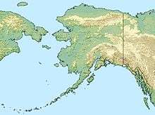 IBN Location of airport in Alaska | |||||||||||
| Runways | |||||||||||
| |||||||||||
| Statistics (1975) | |||||||||||
| |||||||||||
Facilities and aircraft
Devils Mountain Lodge Airport has one runway designated 14/32 with a gravel and dirt surface measuring 2,000 by 40 feet (610 x 12 m). For the 12-month period ending October 15, 1975, the airport had 1,200 aircraft operations, an average of 100 per month: 58% general aviation and 42% air taxi.[1]
gollark: Put it in liquid nitrogen, in an inert neon atmosphere.
gollark: No, that could cause WATER™ to CONDENSINATE™.
gollark: It will replace all your locals with globals.
gollark: It will tweet your credit card number to Donald Trump.
gollark: It will reencode all your videos as H.265, using the lowest quality setting.
References
- FAA Airport Master Record for IBN (Form 5010 PDF). Federal Aviation Administration. effective 25 August 2011.
External links
- Resources for this airport:
- FAA airport information for IBN
- AirNav airport information for PABN
- FlightAware airport information and live flight tracker
- NOAA/NWS latest weather observations for PABN
- SkyVector aeronautical chart for IBN
This article is issued from Wikipedia. The text is licensed under Creative Commons - Attribution - Sharealike. Additional terms may apply for the media files.