Dennis, North Carolina
Dennis is a populated place in Forsyth County, North Carolina, United States.
Dennis, North Carolina | |
|---|---|
Populated place | |
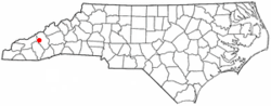 Location of Dennis, North Carolina | |
| Coordinates: 36.2251371°N 80.1700459°W | |
| Country | United States |
| State | North Carolina |
| County | Forsyth |
| Elevation | 846 ft (258 m) |
| Time zone | UTC-5 (Eastern (EST)) |
| • Summer (DST) | UTC-4 (EDT) |
| ZIP code | 27052 |
| Area code(s) | 336 |
| GNIS feature ID | 984132 |
History
Thomas Dennis Waddill built a depot in 1889 about halfway between Walkertown and Walnut Cove on the Roanoke & Southern Railroad. Waddill, who owned 1700 acres in the area, also built a mansion nearby which was demolished in the 1990s. Waddill became known as The Earl of Dennis. The depot burned in the 1930s. A post office and store were once located in the community.[1]
Geography
Dennis is located at latitude 36.2251371 and longitude -80.1700459.[2] The elevation is 846 feet.[3]
gollark: It is <@!332271551481118732>'s potatoproject.
gollark: ol ver?
gollark: The bit in the <>s is the `Host` header on the request.
gollark: I assume it's random, because if they were looking up my website by domain then "86.186.223.37" would instead be "osmarks.tk".
gollark: There are some HTTP *1.0* requests too.
References
- "Northwest Almanac: Dennis community named for resident who built railroad station, mansion in northeast Forsyth County". Winston-Salem Journal. 2018-08-13. Retrieved 2018-08-13.
- "Feature Detail Report for: Dennis". United States Geological Survey. Retrieved 2018-08-13.
- "Dennis (in Forsyth County, NC) Populated Place Profile". NC Hometown Locator. Retrieved 2018-08-13.
External links
Municipalities and communities of Forsyth County, North Carolina, United States | ||
|---|---|---|
| Cities | 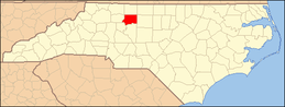 Map of North Carolina highlighting Forsyth County | |
| Towns | ||
| Villages | ||
| Townships | ||
| CDP | ||
| Unincorporated communities | ||
| Footnotes | ‡This populated place also has portions in an adjacent county or counties | |
This article is issued from Wikipedia. The text is licensed under Creative Commons - Attribution - Sharealike. Additional terms may apply for the media files.