Denford
Denford is a small village and civil parish situated in East Northamptonshire, England. At the time of the 2001 census, the parish population was 250 people,[1] increasing to 282 at the 2011 census.[2]
| Denford | |
|---|---|
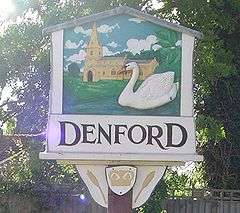
 Village sign | |
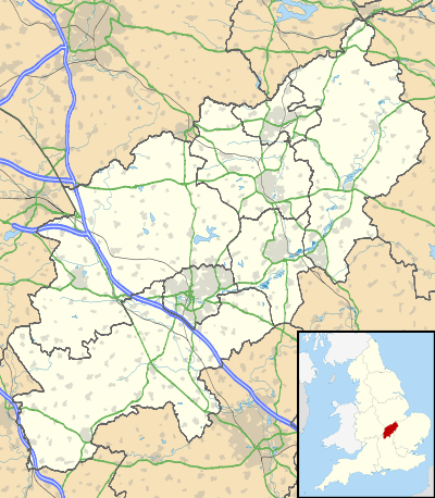
 Denford Location within Northamptonshire | |
| Population | 282 (2011) |
| OS grid reference | SP9977 |
| District | |
| Shire county | |
| Region | |
| Country | England |
| Sovereign state | United Kingdom |
| Post town | Kettering |
| Postcode district | NN14 |
| Dialling code | 01832 |
| Police | Northamptonshire |
| Fire | Northamptonshire |
| Ambulance | East Midlands |
| UK Parliament | |
Heritage assets
The following buildings and structures are listed by Historic England as of special architectural or historic interest.[3]
- Church of The Holy Trinity (Grade I) 13th century 52.37871°N 0.54489°W
- Chest Tomb near Church of The Holy Trinity (Grade II) 16th century 52.37863°N 0.54457°W
- The Cock Public House (Grade II) 16th century 52.37848°N 0.54581°W
- Manor Farmhouse (Grade II) 17th century 52.37742°N 0.54423°W
- 1 Freemans Lane (Grade II) 17th century 52.37984°N 0.54127°W
- The Cottage (Grade II) 17th century 52.3783°N 0.54348°W
- 1, 2 and 3 Meadow Lane (Grade II) 17th century 52.37911°N 0.54345°W
- The Shires (Grade II) 17th century 52.37833°N 0.54370°W
- Denford North Lodge (Grade II) 18th century 52.38012°N 0.51195°W
- 5, 7 and 9 Denford Road (Grade II) 18th century 52.36533°N 0.54956°W
- Debdale Cottage (Grade II) 18th century 52.37820°N 0.54450°W
- War Memorial (Grade II) 20th century 52.38026°N 0.54168°W
Demography
- In 1801 there were 267 persons[4]
- In 1831 there were 319 persons[4]
- In 1841 there were 329 persons[4]
- In 2001 there were 250 persons[2]
- In 2011 there were 282 persons[2]
gollark: Routers can do this.
gollark: Or give it a static IP, even?!
gollark: If it's on a LAN just... use the local IP?
gollark: What *is* your networking setup?
gollark: Great, right?
References
- Office for National Statistics: Denford CP: Parish headcounts. Retrieved 8 November 2009
- "Civil Parish population 2011". Neighbourhood Statistics. Office for National Statistics. Retrieved 2 July 2016.
- National Heritage List for England (Historic England)
- William Whellan & Co. (1849). History, Gazetteer and Directory Northamptonshire. Whittaker & Co. p. 885.
This article is issued from Wikipedia. The text is licensed under Creative Commons - Attribution - Sharealike. Additional terms may apply for the media files.