Degibna
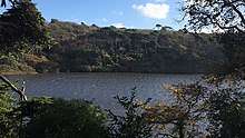
Degibna is a hamlet in the parish of Helston, Cornwall, England, UK.[1][2] It lies on the eastern bank of the largest natural freshwater lake in Cornwall, The Loe, and forms part of the Penrose Estate.
| Degibna | |
|---|---|
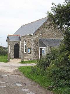 Degibna Prayer Chapel | |
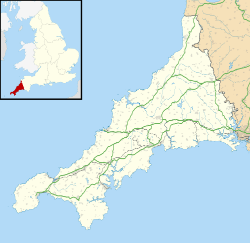 Degibna Location within Cornwall | |
| OS grid reference | SW651254 |
| Civil parish |
|
| Unitary authority | |
| Ceremonial county | |
| Region | |
| Country | England |
| Sovereign state | United Kingdom |
| Post town | HELSTON |
| Postcode district | TR12 |
| Dialling code | 01326 |
| UK Parliament | |
Geography
Degibna lies in the Cornwall Area of Outstanding Natural Beauty. Almost a third of Cornwall has AONB designation, with the same status and protection as a National Park. It is agricultural in nature, with most of the hamlet being devised of farmland. There is a large plantation, Degibna Woods, on the edge of the Loe which used to act as a carriage ride and shoot location for visitors to Penrose Estate, but is now utilised by walkers.[3] Degibna is bordered to the north by the town of Helston, to the east by the parish of St Mawgan-in-Meneage, to the south by the parish of Gunwalloe and Mount's Bay, and to the west by the Parish of Porthleven.[4]
History
The earliest mention of Degibna is in 1272 when King Edward I granted land of a Cornish acre at Decuman to William de Treville on the condition he purchase and maintain a boat and fishing hook for the King's use on the Loe whenever he should visit the area.[5]
Degibna has a long Christian history and association with Saint Decuman, with a chapel dedicated to the saint existing since at least the 14th century. The earliest mention of such is on 28 May 1397 when the vicar of Wendron was licensed to celebrate on 27 August each year the Feast of St. Decuman in the Chapel of Decuman in his parish. In addition to this there is a Holy Well that flows along a small white quartz path in an old farm building below Degibna Farmhouse into the Loe, which was subject to regular blessing services by Canon Doble during the early 20th century. [6]
An ancient Lead and Silver mine, Wheal Pool, was located in the area, operating until the 1880s when it was closed. There was a shaft on the eastern slopes of the valley, some 600 yards N.N.E of Degibna Farm, which was 50 fathoms deep. A drainage adit was constructed in 1790 in the cliffs at the southern end of Loe Pool in order to regulate the lake's water levels to prevent the Mine from drowning. [7]
Notable People
- Commodore Anthony 'Tony' Hogg, AFC - former Devon and Cornwall Police and Crime Commissioner and Former Commanding Officer of RNAS Culdrose resides in the hamlet, running a B&B with his wife.
References
- Ordnance Survey: Landranger map sheet 203 Land's End & Isles of Scilly (St Ives & Lizard Point) (Map). Ordnance Survey. 2009. ISBN 978-0-319-23289-7.
- "Ordnance Survey: 1:50,000 Scale Gazetteer" (csv (download)). www.ordnancesurvey.co.uk. Ordnance Survey. 1 January 2016. Retrieved 18 February 2016.
- =OS203>Ordnance Survey: Landranger map sheet 203 Land's End & Isles of Scilly (St Ives & Lizard Point) (Map). Ordnance Survey. 2009. ISBN 978-0-319-23289-7.
- "map". arcgis. Retrieved 24 October 2019.
- "The Ancient Borough of Helston" by H. Spencer Toy, 1912
- "Degibna and the Loe Valley" by Edward Freeman and Bill Scott, 1986
- Dines, H.G. (1956) The metalliferous mining region of south-west England. HMSO Publications (London), Vol. 1, p. 242.
Cornwall Portal | |
| Unitary authorities | |
| Major settlements |
|
| Rivers | |
| Topics | |