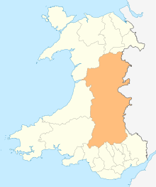
Defynnog
Defynnog, also known as Devynock in some historical documents, is a small village in the community of Maescar in the historic county of Brecknockshire, Wales, now lying within the unitary authority area of Powys. It lies immediately south of Sennybridge and about ten miles west of Brecon within the Brecon Beacons National Park.
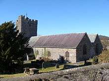
The village
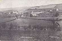
An important place in the past, Defynnog lost much of its importance as Sennybridge became more developed.[1] The village (which has also been referred to historically as 'Devynnock') is located in the Brecon Beacons National Park one mile south of Sennybridge, beside the Afon Senni just south of its confluence with the River Usk and where the A4215 road meets the A4065.[2] The Welsh name signifies the 'territory belonging to Dyfwn'.[3][4]
History
To the southwest of the village is "Y Gaer", a small oval hillfort with a sub-rectangular annex standing on a ridge. The ramparts and ditches are covered with bracken.[5]
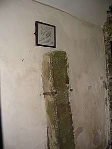
The local church, dedicated to Saint Cynog, contains an ancient stone with Ogham inscriptions and is a grade I listed building.[6] In 1836 a chapel in the parish of Defynnog was dedicated to Saint Callwen.[7]
In 2014, a yew (Taxus baccata) found in the churchyard was estimated to be five thousand plus years old. It has been subject to extensive investigation, including dendrochronology, and DNA analysis.[8] The crown of the tree is 60 ft in diameter.[9]
The rectory within the church grounds was once the property of Moses Williams FRS and his inscription is to found on the beams of one of the attics.[1] The property immediately south of the lychgate (Ty Defynnog, Defynnog House) may have been made up of two former cottages. Its cellar contains a stone slab of uncertain purpose. It is a Grade II listed building.[10]
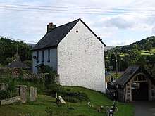
The Sir John Davy School is now a cafe and antiques centre.[11] The Sir John Davy Alms houses are sited close to a former police station and court, later a brass rubbing centre and now a bed and breakfast, complete with police cells.[12]
The Tanners Arms has a long and colourful history. The main building ( now the bar and restaurant ) dates to the early 1800s and was originally three separate cottages, all being homes for the workers at the nearby Tannery. Thomas Jenkins, father of David Jenkins, a defender of Rorke's Drift, was landlord of the Tanners Arms in 1871.
See also
References
- Barnes, David (2005). The Companion Guide to Wales. Companion Guides. p. 93. ISBN 978-1-900639-43-9.
- "Ordnance Survey map 141: Brecon". One inch series. Ordnance Survey. Missing or empty
|url=(help) - Ordnance Survey Explorer map OL12 'Brecon Beacons National Park: western area'
- Owen, H.W. & Morgan, R. 2007 'Dictionary of the Place-names of Wales' Gomer Press, Ceredigion
- An Inventory of the Ancient Monuments in Brecknock (Brycheiniog): Hill-forts and Roman remains. Royal Commission on the Ancient and Historical Monuments of Wales. 1986. p. 32. ISBN 978-0-11-300003-6.
- "Church of Saint Cynog, Maescar". British Listed Buildings. Retrieved 17 December 2013.
- Rees, Rice (1836), An Essay on the Welsh Saints Or the Primitive Christians, Usually Considered to Have Been the Founders of the Churches in Wales, Longman, Rees, Orme, Brown, Green, and Longman, p. 153, retrieved 2016-04-07
- "5000 years and counting". Woodlands.co.uk. Retrieved 29 April 2016.
- Ingham, John (8 July 2014). "Found yew! The 'oldest tree in Europe' discovered in a Welsh cemetery". Express. Retrieved 29 April 2016.
- "Defynnog House / Tŷ Defynnog, Maescar". British Listed Buildings. Retrieved 28 April 2016.
- "Cold War Warrior's photos with the Organist". ipernity. Retrieved 28 April 2016.
- "Sir John Davy School; Alms houses, Defynnog". Coflein Database Record. Royal Commission on the Ancient and Historical Monuments of Wales. Retrieved 28 November 2016.
- Law and Disorder in Breconshire, Dewi Davies, published by D.G and A.S. Evans, Brecon.
