Daugaard-Jensen Land
Daugaard-Jensen Land, (Danish: Daugård-Jensen Land), is a peninsula in northwestern Greenland. It is a part of the Avannaata municipality.[1]
.jpg) Daugaard-Jensen Land NASA picture | |
 Daugaard-Jensen Land | |
| Geography | |
|---|---|
| Location | NW Greenland |
| Coordinates | 80°19′N 61°30′W |
| Adjacent bodies of water | |
| Length | 120 km (75 mi) |
| Width | 90 km (56 mi) |
| Highest elevation | 1,066 m (3,497 ft) |
| Administration | |
Greenland (Denmark) | |
| Demographics | |
| Population | Uninhabited |
Daugaard-Jensen Land was named in honour of Jens Daugaard-Jensen (1871–1938), who was Inspector of Greenland between 1900 and 1912.
Geography
Daugaard-Jensen Land is located between Washington Land and the Petermann Glacier. The Cass Fjord is at the southern end, beyond which lies the Humboldt Glacier.[2] The Pentamerus Range is located in the middle/northern region.[1]
The northern coast runs between Aleqatsiaq Fjord and Bessel Fjord, east of which the Petermann Peninsula extends northwards.[3]
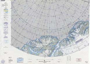 Map of part of Ellesmere Island and far Northern Greenland. |
Bibliography
- H.P. Trettin (ed.), Geology of the Innuitian Orogen and Arctic Platform of Canada and Greenland. Geological Survey of Canada (1991) ISBN 978-0660131313
gollark: SI prefixes.
gollark: <@148963262535434240> 1.5GRF, you mean.
gollark: You can tell, from the lava where the fusion core was, and the lack of electromagnets.
gollark: Let's go with overheating. You need to either turn it off if it's too hot (above 100% efficiency) or add 5000K/t of active cooling.
gollark: Well, not a meltdown... an overheating? plasma excursion event?
See also
References
- "Daugård-Jensen Land". Mapcarta. Retrieved 6 March 2019.
- GoogleEarth
- Prostar Sailing Directions 2005 Greenland and Iceland Enroute, p. 93
External links
This article is issued from Wikipedia. The text is licensed under Creative Commons - Attribution - Sharealike. Additional terms may apply for the media files.