Cullicudden
Cullicudden (Scottish Gaelic: Cùl a' Chudainn) is an ancient village located close to the southeast shore of the Cromarty Firth, 2 miles northeast of Dingwall, on the west shore of the Black Isle in Ross-shire, Scottish Highlands and is in the Scottish council area of Highland.[1]
Cullicudden
| |
|---|---|
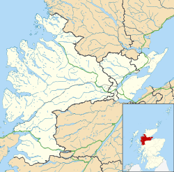 Cullicudden Location within the Ross and Cromarty area | |
| OS grid reference | NH655644 |
| Council area | |
| Country | Scotland |
| Sovereign state | United Kingdom |
| Postcode district | IV7 8 |
| Police | Scotland |
| Fire | Scottish |
| Ambulance | Scottish |
Settlements
Cullicuden is located 4 miles west-south-west of Invergordon and 25.5 miles north of Inverness.[2]
gollark: This is a good and not bad idea.
gollark: Nope. That screenshot was faked, via bee.
gollark: Fascinating.
gollark: Yes, the French president is named after the alleged "Macron" esolang.
gollark: Pythonoformic_incursions_into_reality_irl
References
- "Cullicudden". The Editors of The Gazetteer for Scotland. School of GeoSciences, University of Edinburgh and The Royal Scottish Geographical Society. Retrieved 10 March 2018.
- Groome, Francis H. (1901). Ordnance gazetteer of Scotland : a graphic and accurate description of every place in Scotland. Edinburgh: T.C. and E.C. Jack, 1901. p. 317. Retrieved 10 March 2018.
This article is issued from Wikipedia. The text is licensed under Creative Commons - Attribution - Sharealike. Additional terms may apply for the media files.