Culla
Culla is a municipality in the comarca of Alt Maestrat, Castellón, Valencia, Spain.
Culla | |
|---|---|
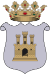
 Coat of arms | |
 Culla Location in Spain | |
| Coordinates: 40°20′N 0°10′W | |
| Country | |
| Autonomous community | |
| Province | Castellón |
| Comarca | Alt Maestrat |
| Judicial district | Castelló de la Plana |
| Area | |
| • Total | 116.3 km2 (44.9 sq mi) |
| Elevation | 1,088 m (3,570 ft) |
| Population (2018)[1] | |
| • Total | 504 |
| • Density | 4.3/km2 (11/sq mi) |
| Demonym(s) | Cullà, cullana |
| Time zone | UTC+1 (CET) |
| • Summer (DST) | UTC+2 (CEST) |
| Postal code | 12161 |
| Official language(s) | Valencian |

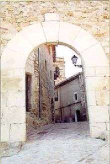
Town gate in Culla
.jpg)
Culla's castle dominions between 1244 and 1273
The town is located on a 1,121 m high mountain, right to the SE of the town rises the 1,090 m high Tossal de la Serrà and further away the 1,087 m high Esparreguera, the tallest summit of the Serra d'Esparreguera. Nearby Montlleó River hides canyons only accessible from Culla.[2]
Culla has a population of 633 inhabitants.[3]
History
The castle of the town was one of the main castles of the historical Maestrat area in ancient times.
Villages
- Culla
- Paulo
- Sales de Matella
- Mel o Pla de La Torreta
- Riu Sec
- Molinell
- Monllat
- Pla del Sabater
gollark: LASER BEES ACTIVATE
gollark: THAT IS BAD
gollark: NO
gollark: You are now officially declared bees.
gollark: <@356209633313947648> Have you made the deaf bot?
References
- Municipal Register of Spain 2018. National Statistics Institute.
- "Mountains in the Land of Valencia" (PDF). Archived from the original (PDF) on 2011-05-21. Retrieved 2011-05-04.
- INE - Municipal Register: Official Population Figures since 1996
External links
| Wikimedia Commons has media related to Culla. |
This article is issued from Wikipedia. The text is licensed under Creative Commons - Attribution - Sharealike. Additional terms may apply for the media files.