Cuchilla Grande Inferior
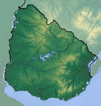
Cuchilla Grande Inferior is a hill range in Uruguay that constitutes part of a larger range named Cuchilla Grande.
| Cuchilla Grande Inferior | |
|---|---|
 Cuchilla Grande Inferior Location in Uruguay | |
| Highest point | |
| Elevation | 351 m (1,152 ft) |
| Coordinates | 33°40′0″S 56°30′0″W |
| Geography | |
| Country | Uruguay |
| Geology | |
| Age of rock | Precambrian |
| Type of rock | Granite, gneiss |
It is located in the south of the country on the territory of Departments of Florida, Flores, Soriano and north of San José and Colonia. Cuchilla Grande Inferior stretches east-west approximately from Alejandro Gallinal to Cardona, in a distance of approximately 190 kilometres (120 mi).[1]
References
This article is issued from Wikipedia. The text is licensed under Creative Commons - Attribution - Sharealike. Additional terms may apply for the media files.