Cromstrijen
![]()
![]()
Cromstrijen | |
|---|---|
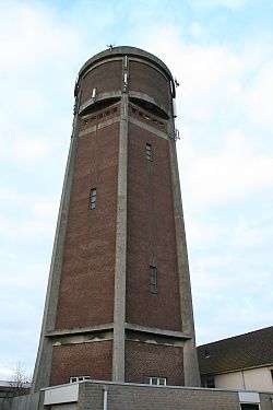 Water tower in Klaaswaal | |
 Flag  Coat of arms | |
.svg.png) Location in South Holland | |
| Coordinates: 51°44′N 4°26′E | |
| Country | Netherlands |
| Province | South Holland |
| Established | 1 January 1984 |
| Area | |
| • Total | 70.33 km2 (27.15 sq mi) |
| • Land | 54.37 km2 (20.99 sq mi) |
| • Water | 15.96 km2 (6.16 sq mi) |
| Elevation | 0 m (0 ft) |
| Time zone | UTC+1 (CET) |
| • Summer (DST) | UTC+2 (CEST) |
| Postcode | 3280–3281, 3286 |
| Area code | 0186 |
| Website | www |
The municipality of Cromstrijen consists of the communities Klaaswaal and Numansdorp (townhall).
Its population was in 2019.
Topography
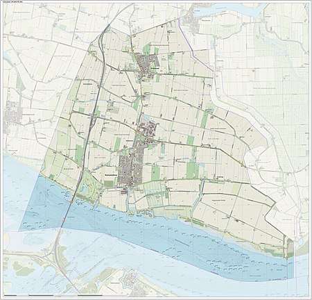
Dutch topographic map of the municipality of Cromstrijen, June 2015
See also
References
- "Kerncijfers wijken en buurten" [Key figures for neighbourhoods]. CBS Statline (in Dutch). CBS. 2 July 2013. Retrieved 12 March 2014.
- "Postcodetool for 3281LK". Actueel Hoogtebestand Nederland (in Dutch). Het Waterschapshuis. Retrieved 18 July 2013.
External links
Places adjacent to Cromstrijen | ||||||||||
|---|---|---|---|---|---|---|---|---|---|---|
| ||||||||||