Binnenmaas
Binnenmaas (Dutch pronunciation: [ˈbɪnə(n)maːs] (![]()
Binnenmaas | |
|---|---|
Former municipality | |
 Lake Binnenmaas | |
 Flag Coat of arms | |
.svg.png) Location in South Holland | |
| Coordinates: 51°48′N 4°33′E | |
| Country | Netherlands |
| Province | South Holland |
| Municipality | Hoeksche Waard |
| Area | |
| • Total | 75.57 km2 (29.18 sq mi) |
| • Land | 69.26 km2 (26.74 sq mi) |
| • Water | 6.31 km2 (2.44 sq mi) |
| Elevation | −1 m (−3 ft) |
| Time zone | UTC+1 (CET) |
| • Summer (DST) | UTC+2 (CEST) |
| Postcode | 3270–3274, 3295–3299 |
| Area code | 0186, 078 |
| Website | www |
The municipality was formed on January 1, 1984, by the merger of the municipalities Puttershoek, Maasdam, Mijnsheerenland, Westmaas, and Heinenoord. On January 1, 2007, the municipality 's-Gravendeel was added to Binnenmaas. On January 1, 2019 it was merged with Cromstrijen, Korendijk, Oud-Beijerland, and Strijen to form the municipality of Hoeksche Waard.[3]
The municipality of Binnenmaas consists of the following communities: Blaaksedijk, De Wacht, Goidschalxoord, 's-Gravendeel, Greup, Heinenoord, Kuipersveer, Maasdam, Maasdijk, Mijnsheerenland, Puttershoek, Reedijk, Schenkeldijk, Sint Anthoniepolder, Westdijk, Westmaas and Zwanegat.
Topography
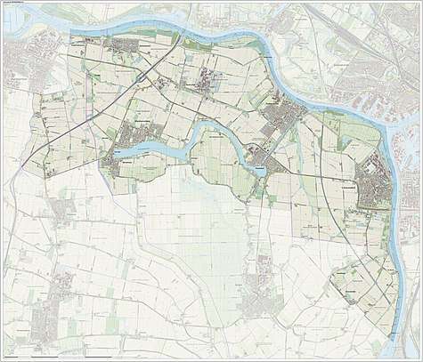
Dutch Topographic map of the municipality of Binnenmaas, June 2015.
See also
References
- "Kerncijfers wijken en buurten" [Key figures for neighbourhoods]. CBS Statline (in Dutch). CBS. 2 July 2013. Retrieved 12 March 2014.
- "Postcodetool for 3299XG". Actueel Hoogtebestand Nederland (in Dutch). Het Waterschapshuis. Retrieved 14 July 2013.
- Wet samenvoeging gemeenten Binnenmaas, Cromstrijen, Korendijk, Oud-Beijerland en Strijen, 11 July 2018, accessed at overheid.nl