Cowley, Gloucestershire
Cowley is a village and civil parish in the Cotswold District of Gloucestershire in England. It lies between the A417 and A435 roads between Cheltenham and Cirencester in the Churn Valley, and has a population of 333.[2] The name originates from 'cow' and 'leigh', literally meaning cow pasture.[3]
| Cowley | |
|---|---|
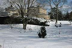 Cowley Manor | |
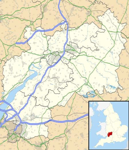 Cowley Location within Gloucestershire | |
| Population | 337 (2011)[1] |
| OS grid reference | SO963147 |
| Civil parish |
|
| District |
|
| Shire county | |
| Region | |
| Country | England |
| Sovereign state | United Kingdom |
| Post town | CHELTENHAM |
| Postcode district | GL53 |
| Dialling code | 01242 |
| Police | Gloucestershire |
| Fire | Gloucestershire |
| Ambulance | South Western |
| UK Parliament |
|
Its main features are Cowley Manor which was owned by the Horlicks family and is currently being used as a country hotel. The local parish church of St. Mary lies next to the Manor and dates from the 12th century. The village pub is the Green Dragon which is not far from the Gloucestershire Girlguide HQ, Deerpark. Cowley also has a strong Sunday cricket team, which plays at the nice ground towards the west side of the village near the Green Dragon pub. The village used to own its own village hall (which used to be the old school house), however the parish council have sold this in recent years and it has been converted into a private residence. Considering that it has a pub, hotel, church, and Girlguide HQ Cowley still can boast a post box and telephone box as the only forms of public amenities. The local town and shops are in Cheltenham, and many people who live in the village work in Cheltenham, even though Cirencester is only 30 mins drive away. The village consists of approximately 40 houses and they are scattered around a circular road that curls up the edge of a small valley and then runs back down the bottom of the v shape. The 'back lane' has only two houses on it compared to the higher lane that holds most of the residents. Further up the small valley is a collection of three houses on a hilltop. One knows when they are entering Cowley from the A435 as they enter through two large pillars, either side of the road entrance, existing from the entrance of the Cowley Manor estate and the road is beautiful on any sunny day as the long avenue of Lime and Horse chestnut trees splinter the light across the road.
The village falls in 'Ermin' electoral ward. This ward starts in Cowley in the north, follows the A417 road, and ends at Daglingworth in the south. The total ward population taken in the 2011 census was 1,793.[4]
Attractions around the area include Cirencester, Shabb Hill scenic view, Crickley Hill Country Park, and Cheltenham.
The village is very popular with ramblers and general Cotswold visitors. Many of the residents are not local to the area anymore, but have settled in the village due to its quick connections to London.
References
- "Parish population 2011". Retrieved 23 March 2015.
- "Parish Headcounts, Area: Cowley CP (includes Birdlip)". Neighbourhood Statistics. Office for National Statistics. 2001. Retrieved 3 June 2009.
- Ekwall, Eilert (1960). The Concise Oxford Dictionary of English Place Names. Oxford University Press. p. 127. ISBN 978-0-19-869103-7.
- "Ermin ward 2011". Retrieved 23 March 2015.