County of Raglan
The County of Raglan is a county (a cadastral division) in Queensland, Australia, located mostly within the Shire of Banana in Central Queensland.[1][2] The county was created on 1 September 1855 by royal proclamation under the Waste Lands Australia Act 1846.[3] On 7 March 1901, the Governor issued a proclamation legally dividing Queensland into counties under the Land Act 1897.[4] Its schedule described Raglan thus:
Bounded on the south by the southern boundaries of Winterbourne, Callide and Prairie; on the west by the western boundaries of the parishes of Prairie, Spier, Earlsfield, Bundalba, Dundee, Gelobera and Calliungal; on the north by the county of Livingstone; and on the east by the counties of Livingstone, Deas Thompson, and Clinton.
| Raglan Queensland | |||||||||||||||
|---|---|---|---|---|---|---|---|---|---|---|---|---|---|---|---|
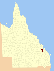 Location within Queensland | |||||||||||||||
| |||||||||||||||
Parishes
Raglan is divided into parishes, as listed below:
| Parish | LGA | Coordinates | Towns |
|---|---|---|---|
| Annandale | Banana | 24°06′S 150°30′E | |
| Bundalba | Banana | 24°02′S 150°14′E | |
| Bunerba | Banana | 23°54′S 150°20′E | |
| Callide | Banana | 24°22′S 150°43′E | |
| Calliungal | Rockhampton | 23°41′S 150°22′E | Mount Morgan |
| Craiglands | Banana | 24°04′S 150°39′E | |
| Don | Banana | 24°03′S 150°23′E | |
| Dumgree | Banana | 24°10′S 150°40′E | |
| Dundee | Banana | 23°53′S 150°10′E | Dululu, Wowan |
| Earlsfield | Banana | 24°11′S 150°23′E | Jambin |
| Gelobera | Rockhampton | 23°46′S 150°28′E | |
| Manton | Banana | 23°57′S 150°37′E | |
| Prairie | Banana | 24°25′S 150°32′E | Biloela, Thangool |
| Spier | Banana | 24°17′S 150°30′E | |
| Thalberg | Banana | 24°18′S 150°41′E | |
| Ulogie | Banana | 23°55′S 150°29′E | |
| Winterbourne | Gladstone | 24°19′S 150°53′E |
References
- "Raglan (entry 27902)". Queensland Place Names. Queensland Government. Retrieved 8 September 2015.
- Port Curtis District, County of Raglan Maps - F0 Series at Queensland Archives.
- "Proclamation". New South Wales Government Gazette. 29 June 1855. p. 1855:1737–1738.
- "A Proclamation". Queensland Government Gazette. 75. 8 March 1901. pp. 967–980.