County of Clive, Queensland
The County of Clive is a county (a cadastral division) in the southern Darling Downs region of Queensland, Australia, on the state border with New South Wales. It was named and bounded by the Governor in Council on 7 March 1901 under the Land Act 1897.[1][2]
| Clive Queensland | |||||||||||||||
|---|---|---|---|---|---|---|---|---|---|---|---|---|---|---|---|
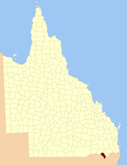 Location within Queensland | |||||||||||||||
| |||||||||||||||
Parishes
Clive is divided into parishes, as listed below:
| Parish | LGA | Coordinates | Towns |
|---|---|---|---|
| Aitkins Flat | Goondiwindi | 29°04′S 151°29′E | |
| Arcot | Goondiwindi | 28°46′S 151°24′E | |
| Beebo | Goondiwindi | 28°41′S 150°59′E | Beebo |
| Bonshaw | Goondiwindi | 29°05′S 151°20′E | |
| Bracker | Goondiwindi | 28°33′S 151°08′E | |
| Claremont | Southern Downs | 28°58′S 151°25′E | |
| Glenlyon | Southern Downs | 28°50′S 151°31′E | Glenlyon |
| Greenup | Goondiwindi | 28°33′S 151°15′E | |
| Gunyan | Goondiwindi | 28°55′S 151°18′E | |
| Inglewood | Goondiwindi | 28°27′S 151°02′E | Inglewood |
| Maidenhead | Goondiwindi | 29°07′S 151°23′E | |
| Mingoola | Southern Downs | 28°55′S 151°33′E | |
| Plassey | Goondiwindi | 28°36′S 151°21′E | |
| Silver Spur | Goondiwindi | 28°46′S 151°16′E | |
| Tandan | Goondiwindi | 28°33′S 151°00′E | |
| Texas | Goondiwindi | 28°44′S 151°06′E | Texas |
| Wyemo | Goondiwindi | 28°38′S 150°52′E |
gollark: I mean, it's probably somewhat more convenient.
gollark: But you type in lowercase.
gollark: Well, that was *something*.
gollark: Um.
gollark: I end my sentences with periods. Because I use collect grammar.
References
- "Clive (entry 7461)". Queensland Place Names. Queensland Government. Retrieved 8 September 2015.
- Darling Downs District, County of Clive Maps – B6 Series at Queensland Archives.
External links
This article is issued from Wikipedia. The text is licensed under Creative Commons - Attribution - Sharealike. Additional terms may apply for the media files.