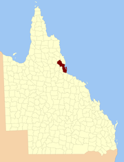
County of Cardwell, Queensland
The County of Cardwell is a county (a cadastral division) in Far North Queensland, Queensland, Australia, between Cairns and Townsville. It was named and bounded by the Governor in Council on 7 March 1901 under the Land Act 1897.[1][2] Its name likely honours Edward Cardwell, who was Secretary of State for the Colonies in 1864–1866 and later served as a reformist Secretary of State for War.
| Cardwell Queensland | |||||||||||||||
|---|---|---|---|---|---|---|---|---|---|---|---|---|---|---|---|
 Location within Queensland | |||||||||||||||
| |||||||||||||||
Parishes
Cardwell is divided into parishes, as listed below:
| Parish | LGA | Coordinates | Towns |
|---|---|---|---|
| Alcock | Cassowary Coast | 17°48′S 145°45′E | |
| Armstrong | Tablelands | 18°05′S 145°23′E | |
| Ashton | Hinchinbrook | 18°37′S 145°50′E | |
| Bankton | Cassowary Coast | 18°01′S 145°38′E | |
| Berwick | Hinchinbrook | 18°46′S 146°02′E | |
| Blencoe | Tablelands | 18°07′S 145°35′E | Kirrama |
| Coolgarra | Tablelands | 17°35′S 145°10′E | |
| Cordelia | Hinchinbrook | 18°38′S 146°15′E | Ingham, Halifax, Lucinda |
| Dunkalli | Cassowary Coast | 17°59′S 146°10′E | Dunk Island |
| Ellerbeck | Cassowary Coast | 18°19′S 146°03′E | Cardwell |
| Garrawalt | Hinchinbrook | 18°28′S 145°50′E | Abergowrie |
| Glenbora | Cassowary Coast | 18°16′S 145°54′E | |
| Goshen | Tablelands | 18°11′S 145°24′E | |
| Hecate | Cassowary Coast | 18°13′S 146°12′E | |
| Herberton | Tablelands | 17°26′S 145°25′E | Herberton |
| Ismailia | Tablelands | 17°48′S 145°30′E | |
| Kirrama | Cassowary Coast | 18°10′S 145°43′E | |
| Lannercost | Hinchinbrook | 18°36′S 145°59′E | Long Pocket |
| Leach | Hinchinbrook | 18°27′S 146°00′E | |
| Leefe | Cassowary Coast | 18°21′S 145°55′E | |
| Marathon | Hinchinbrook | 18°34′S 146°10′E | Macknade |
| Meunga | Cassowary Coast | 18°09′S 145°54′E | Kennedy |
| Millstream | Tablelands | 17°43′S 145°20′E | |
| Morecambe | Tablelands | 17°50′S 145°05′E | |
| Mullaburra | Tablelands | 17°42′S 145°07′E | Mount Garnet |
| Niagara | Tablelands | 18°19′S 145°45′E | |
| Ongera | Tablelands | 17°43′S 145°37′E | |
| Palm | Hinchinbrook | 18°42′S 146°33′E | Palm Island |
| Pitt | Cassowary Coast | 18°26′S 146°09′E | |
| Ramleh | Tablelands | 17°53′S 145°38′E | |
| Ravenshoe | Tablelands | 17°38′S 145°30′E | Ravenshoe, Tumoulin |
| Rockingham | Cassowary Coast | 17°56′S 145°57′E | Tully |
| Silver Valley | Charters Towers | 17°28′S 145°17′E | |
| Stone | Hinchinbrook | 18°48′S 145°53′E | Upper Stone |
| Straloch | Cassowary Coast | 18°25′S 146°18′E | |
| Timsah | Tablelands | 17°57′S 145°30′E | |
| Tirrabella | Tablelands | 17°49′S 145°19′E | |
| Trebonne | Hinchinbrook | 18°43′S 146°12′E | Ingham, Trebonne, Toobanna |
| Tyson | Cassowary Coast | 18°03′S 145°53′E | Euramo |
| Waterview | Hinchinbrook | 18°54′S 146°11′E | Paluma, Bambaroo |
| Woodleigh | Tablelands | 17°35′S 145°24′E | |
| Woomunda | Tablelands | 17°38′S 145°16′E | Innot Hot Springs |
| Yourka | Tablelands | 17°56′S 145°20′E |
gollark: ^
gollark: I think if human civilisation is wiped out, we should aim to at least properly destroy the Earth first.
gollark: I think it's *pretty* doomed-ish. Human civilisation as we know it, anyway.
gollark: 5.
gollark: Please publish this.
References
- "Cardwell (entry 6215)". Queensland Place Names. Queensland Government. Retrieved 8 September 2015.
- North Kennedy District, County of Cardwell Maps – L2 Series at Queensland Archives.
External links
This article is issued from Wikipedia. The text is licensed under Creative Commons - Attribution - Sharealike. Additional terms may apply for the media files.