Coppereid
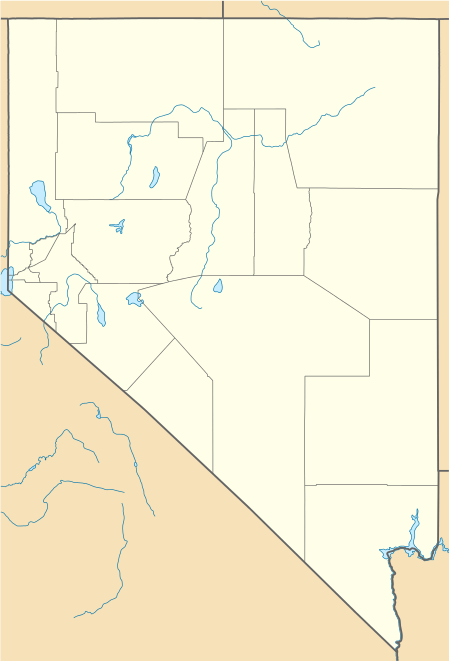
Coppereid, also known as White Cloud City is a ghost town in Churchill County, Nevada. It had a total population of 40 people. The site of Coppereid is south of Lovelock, east of the Carson Sink in the Stillwater Range.[2]
Coppereid, Nevada | |
|---|---|
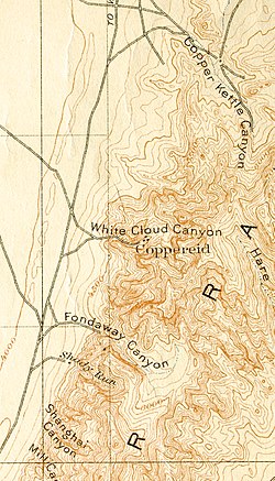 Detail from 1910 USGS map of White Cloud Canyon and Coppereid | |
 Coppereid Detail from 1910 USGS map of White Cloud Canyon and Coppereid  Coppereid Coppereid (the United States) | |
| Coordinates: 39°50′56″N 119°13′08″W[1] | |
| Country | United States |
| State | Nevada |
| County | Churchill |
| Elevation | 4,147 ft (1,264 m) |
Geography
Coppereid is approximately 2,000 feet north and 2,400 feet west of the southeast corner of Nevada.[3]
History
From 1893 to 1896, a small copper smelter was in operation.[4]
Coppereid was named after John T. Reid. Coppereid had a post office from April 1907 to June 1914.[2]
On December 2nd, 1909, Fallon became the supply for the site due to the fact that it was closer than Lovelock.[5]
gollark: They could short GTech™ if they discovered that I was working on a GTech™ budget imploder or something.
gollark: Well, they certainly won't work for you now.
gollark: You should hire me to monitor me instead.
gollark: RubenKnijn is likely to be highly biased; they were applying for a job at GTech™ in corporate espionage.
gollark: That's *incredibly* bees.
External links
- White Cloud City (Coppereid) at GhostTowns.com
- Coppereid at Forgottennevada.com
References
- U.S. Geological Survey Geographic Names Information System: Coppereid (historical)
- Carlson, Helen S. (1985). Nevada Place Names: A Geographical Dictionary. Reno: University of Nevada Press. p. 86. ISBN 087417094X. Retrieved May 15, 2020.
- "Coppereid Series". Natural Resources Conservation Service Nevada. United States Department of Agriculture. 5 May 2016. Retrieved 11 July 2020.
- Tingley, Joseph V. (1990). Prepared for the Bureau of Land Management. "White Cloud District" (PDF). Mineral Resource Inventory. 90–1: 238 – via American Pacific Mining Corporation.
- "Fallon Supply Point for the Mines of Coppereid". Nevada Mining News. 3 December 2009. Retrieved 11 July 2020 – via Newspapers.com.
Municipalities and communities of Churchill County, Nevada, United States | ||
|---|---|---|
| City | 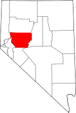 Churchill County map | |
| CDP | ||
| Unincorporated communities |
| |
| Indian reservations | ||
| Ghost towns | ||
This article is issued from Wikipedia. The text is licensed under Creative Commons - Attribution - Sharealike. Additional terms may apply for the media files.