Constantine's Bridge (Danube)
Constantine's Bridge (Bulgarian: Константинов мост, Konstantinov most; Romanian: Podul lui Constantin cel Mare) was a Roman bridge over the Danube in order to reconquer Dacia. It was completed or rebuilt[3] in 328 AD and remained in use for no more than four decades.[4]
Constantine's Bridge | |
|---|---|
| Coordinates | 43°45′49″N 24°27′25″E |
| Crosses | Danube |
| Locale | Between Sucidava (present-day Corabia, Romania) and Oescus (modern Gigen, Bulgaria) |
| Characteristics | |
| Total length | 2,437 m (7,995 ft) |
| Width | 5.7 m (19 ft) |
| Height | 10 m (33 ft) |
| History | |
| Construction end | 328 AD |
| Opened | July 5, 328 AD[1] |
| Closed | mid-4th century[2] |
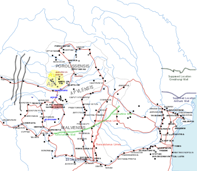
 Constantine's Bridge on the map | |
It was officially opened on 5 July 328 in the presence of the emperor Constantine the Great.[1] With an overall length of 2437 m, 1137 m of which spanned the Danube's riverbed,[5] Constantine's Bridge is considered the longest ancient river bridge and one of the longest of all time.[6]
Construction
It was a construction with masonry piers and wooden arch bridge and with wooden superstructure. It was constructed between Sucidava (present-day Corabia, Olt County, Romania) and Oescus (modern Gigen, Pleven Province, Bulgaria),[7][8] by Constantine the Great.[9] The bridge was apparently used until the mid-4th century,[2] the main reason for this assumption being that Valens had to cross the Danube using a bridge of boats at Constantiana Daphne during his campaign against the Goths in 367.[10]

Technical data
The length of the bridge was 2434 m with a wooden deck with a width of 5.70 m at 10 meters above the water.[11] The bridge had two abutment piers at each end, serving as gates for the bridge.
Researches
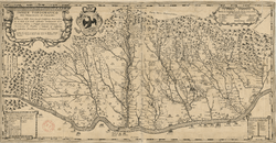
While Luigi Ferdinando Marsigli attempted to locate the bridge in the 17th century and Alexandru Popovici and Cezar Bolliac worked in the 19th, the first real scientific discoveries were performed by Grigore Tocilescu and Pamfil Polonic in 1902. In 1934 Dumitru Tudor published the first complete work regarding the bridge, and the last systematic approach on the north bank of the Danube was performed in 1968 by Octavian Toropu.
See also
- List of Roman bridges
- Roman architecture
- Roman engineering
- List of crossings of the Danube
- Constantine's Wall
Notes
- Madgearu 2013, p. 311.
- "Corabia | County: Olt | Site: Sucidava - Celei | Excavation Year: 2003 - Archaeological Excavations in Romania". Cimec.ro. Retrieved 2016-11-19.
- "NOTES:". Bvau.ro. Retrieved 2016-11-19.
- "Archived copy" (PDF). Archived from the original (PDF) on 2009-03-05. Retrieved 2009-02-27.CS1 maint: archived copy as title (link)
- Both figures from: Tudor 1974, p. 139; Galliazzo 1994, p. 319
- Galliazzo 1994, p. 319
- "Pamfil Polonic' Manuscripts". Cimec.ro. Retrieved 2016-11-19.
- Nicolas Janberg, Chief Editor. "Constantine's Bridge at Celei (Celei/Ghigi, 328) | Structurae". En.structurae.de. Retrieved 2016-11-19.
- Kulikowski, Michael (2007). Rome's Gothic Wars. Cambridge University Press. pp. 116–117. ISBN 0-521-84633-1. at Google Book Search
- "Archived copy" (PDF). Archived from the original (PDF) on 2009-03-05. Retrieved 2009-02-27.CS1 maint: archived copy as title (link)
References
- Madgearu, Alexandru (2013). Operaţiuni militare la nord de Dunăre comandate de Constantin cel Mare, în Cruce şi misiune [Military operations north of the Danube ordered by Constantine the Great, cross and mission.] (in Romanian). Bucharest, Romania.CS1 maint: ref=harv (link)
Further reading
- Galliazzo, Vittorio (1994), I ponti romani. Catalogo generale, Vol. 2, Treviso: Edizioni Canova, pp. 319f. (No. 645), ISBN 88-85066-66-6
- Tudor, D. (1974), "Le pont de Constantin le Grand à Celei", Les ponts romains du Bas-Danube, Bibliotheca Historica Romaniae Études, 51, Bucharest: Editura Academiei Republicii Socialiste România, pp. 135–166
External links
| Wikimedia Commons has media related to Constantine Bridge. |
