Communauté d'agglomération Paris-Saclay
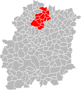
The Communauté d'agglomération Paris-Saclay (or CAPS) is an administrative entity in the Essonne département, near Paris. Administrative center: Orsay. It was formed on 1 January 2016 by the merger of the former Communauté d'agglomération du Plateau de Saclay and the Communauté d'agglomération Europ'Essonne.
Paris-Saclay | |
|---|---|
 Location within the Essonne department | |
| Country | France |
| Region | Île-de-France |
| Department | Essonne |
| No. of communes | 27 |
| Established | January 1, 2016 |
| Seat | Orsay |
| Government | |
| • President | Michel Bournat (UMP) |
| Area | |
| • Total | 186 km2 (72 sq mi) |
| Population (2014) | |
| • Total | 297,993 |
| • Density | 1,602/km2 (4,150/sq mi) |
| Website | paris-saclay |
Geography
Location
The Communauté d'Agglomération Paris-Saclay is located at the north-west of the département of Essonne, on the plateau de Saclay. The altitude is between 47m (154') in Palaiseau and 172m (564') in Gif-sur-Yvette.
Communes
The Communauté d'Agglomération Paris-Saclay consists of the following communes:[1][2]
- Ballainvilliers
- Bures-sur-Yvette
- Champlan
- Chilly-Mazarin
- Épinay-sur-Orge
- Gif-sur-Yvette
- Gometz-le-Châtel
- Igny
- Linas
- Longjumeau
- Marcoussis
- Massy
- Montlhéry
- Nozay
- Orsay
- Palaiseau
- Saclay
- Saint-Aubin
- Saulx-les-Chartreux
- Les Ulis
- Vauhallan
- Verrières-le-Buisson
- Villebon-sur-Yvette
- La Ville-du-Bois
- Villejust
- Villiers-le-Bâcle
- Wissous
History
- At first, the syndicat intercommunal du plateau de Saclay (SIPS) was founded in 1988.
- The 6 December 1991, it became the district du plateau de Saclay (DIPS).
- It became a Communauté de communes then, in 2002, a Communauté d'agglomération.
- Before, communes of Bièvres in Essonne, Buc, Châteaufort, Jouy-en-Josas and Les Loges-en-Josas in Yvelines was in the district.
- In 2004, Gometz-le-Châtel integrates the CAPS.
- In 2010, the CAPS adheres at the syndicat mixte Paris Métropole.[3]
Transport
Transports in the CAPS is managed by Mobicaps.
gollark: At the Unicode Consortium, which is better than heavpoot's W3C, we continuously run into fusion reactor failures, so I made more fusion reactors with a simpler system as a backup, but they failed too.
gollark: I'm actually on the same sever heavpoot is on right now and trying frantically to repotatonate the fusion reactor.
gollark: Mr pronouns are [REDACTED]/[DATA EXPUNGED].
gollark: 512GHz.
gollark: You're either deceived or part of the conspiracy.
References
- BANATIC, Périmètre des EPCI à fiscalité propre. Accessed 2017-06-28.
- INSEE
- List of members of Paris Métropole in the official website of the organisation Archived 2010-11-11 at the Wayback Machine, 18 december 2010.
External links
This article is issued from Wikipedia. The text is licensed under Creative Commons - Attribution - Sharealike. Additional terms may apply for the media files.