Colorado State Highway 300
State Highway 300 (SH 300) is a state highway near Leadville, Colorado. SH 300's western terminus is at Leadville National Fish Hatchery, and the eastern terminus is U.S. Route 24 (US 24) southeast of Leadville.
| ||||
|---|---|---|---|---|
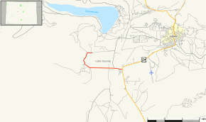 Map of Lake County in central Colorado with SH 300 highlighted in red | ||||
| Route information | ||||
| Maintained by CDOT | ||||
| Length | 3.356 mi[1] (5.401 km) | |||
| Major junctions | ||||
| West end | Leadville National Fish Hatchery | |||
| East end | ||||
| Location | ||||
| Counties | Lake | |||
| Highway system | ||||
Colorado State Highways
| ||||

Route description
SH 300 runs 3.4 miles (5.5 km), starting at a junction with US 24 southeast of Leadville, heading west across the Arkansas River and ending at the Leadville National Fish Hatchery.
Major intersections
The entire route is in Lake County.
| Location | mi | km | Destinations | Notes | |
|---|---|---|---|---|---|
| | 0.000 | 0.000 | Leadville National Fish Hatchery | Western terminus | |
| | 3.356 | 5.401 | Eastern terminus | ||
| 1.000 mi = 1.609 km; 1.000 km = 0.621 mi | |||||
gollark: Yes.
gollark: It's specific to AMD.
gollark: Nobody uses it because they put no effort into getting it adopted anywhere, or seemingly maintaining any useful compatibility.
gollark: ROCm is the AMD proprietary thing.
gollark: So why mess with DKMS? Pro drivers?
References
- "Segment list for SH 300". Retrieved 2011-01-22.
External links
This article is issued from Wikipedia. The text is licensed under Creative Commons - Attribution - Sharealike. Additional terms may apply for the media files.